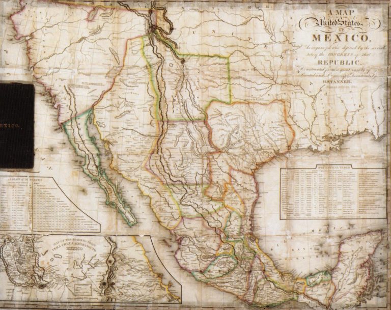
This large pocket map includes two insets, a) Table of Distances and b) Map of the Roads from Vera Cruz … See more Map of the United States of Mexico as Organized and Defined by the Congress of that Republic
Geography: Texas (9 Maps with Images)
Show All Maps12
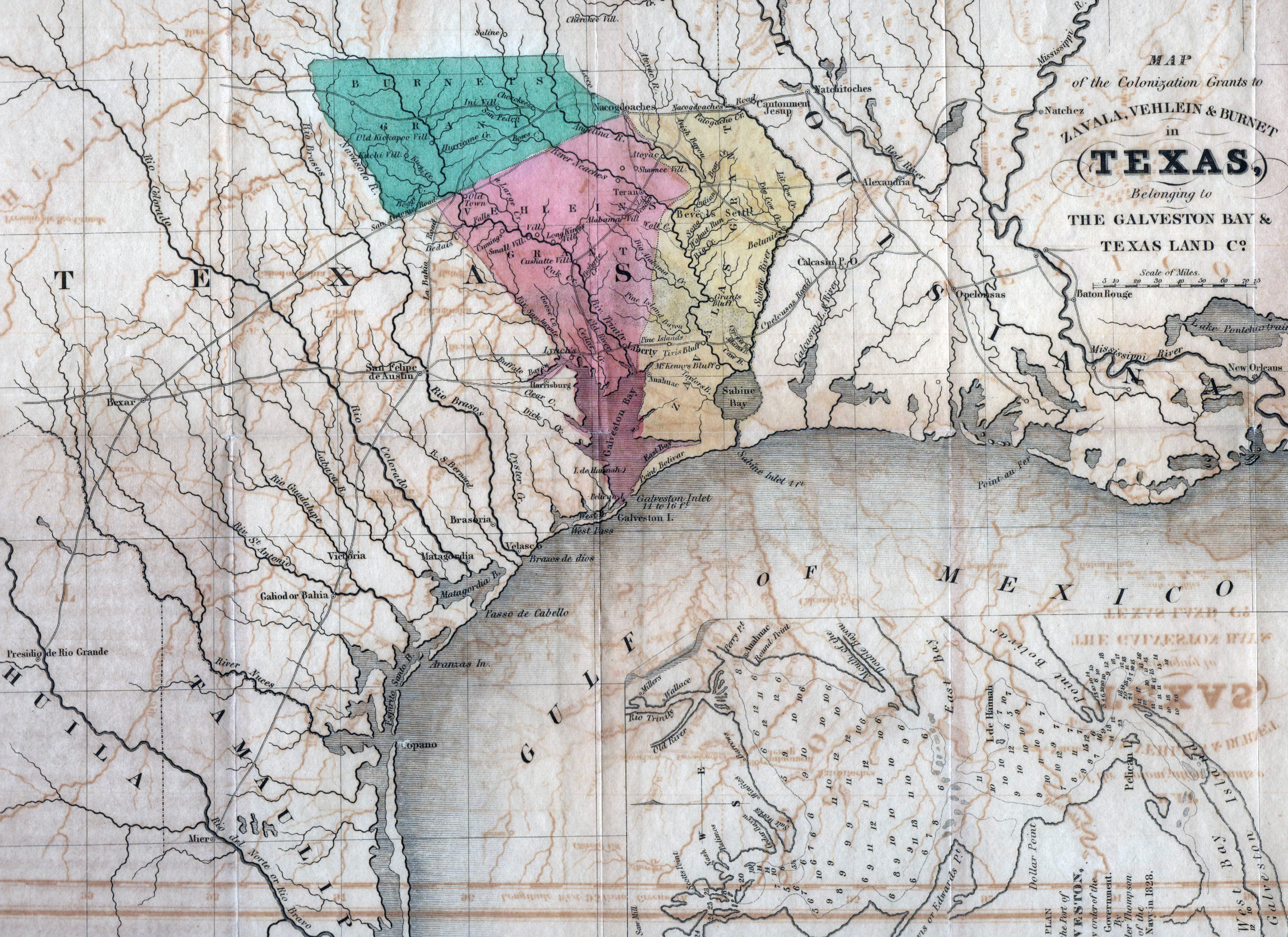
1835: Map of the Grants to Zavala, Vehlein & Burnet in Texas, belonging to The Galveston Bay & Texas Land Co.
Cartography:
David Woodman
David Woodman
This map was published in Woodman’s “Guide to Texas Emigrants,” the first Texas guide printed in English. The main purpose … See more Map of the Grants to Zavala, Vehlein & Burnet in Texas, belonging to The Galveston Bay & Texas Land Co.
13
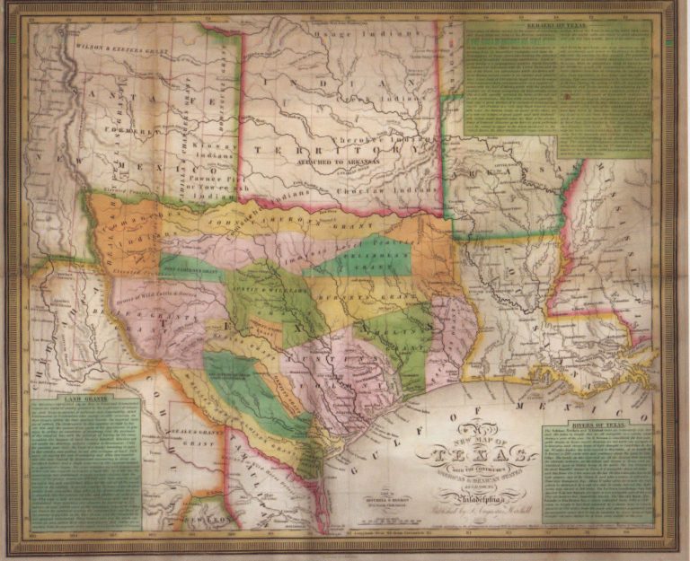
1835: A New Map of Texas
Cartography:
J. H. Young
J. H. Young
One of the most influential of the Republic of Texas maps, just predating the revolution by months. This map was … See more A New Map of Texas
14
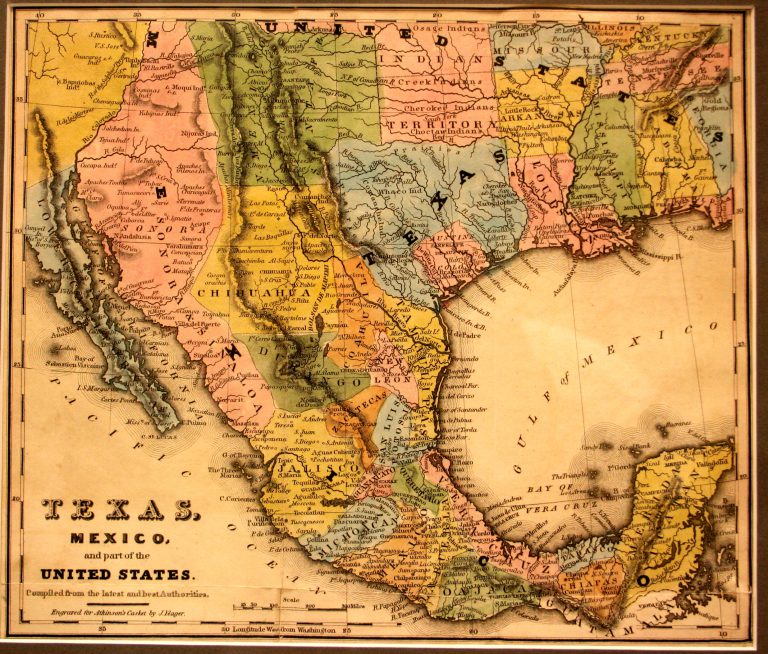
1836: Texas, Mexico and Part of the United States
Cartography:
Joseph Yeager
Joseph Yeager
On the 2nd of March, 1836, along the banks of Brazos River, as Santa Anna was laying siege to the … See more Texas, Mexico and Part of the United States
15
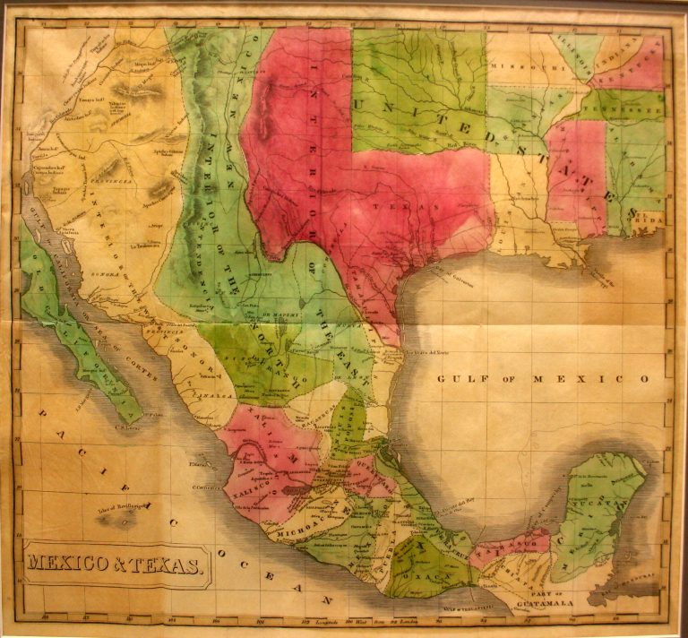
1837: Mexico & Texas
Cartography:
John Milton Niles
John Milton Niles
This 1837 map shows the Republic of Texas extending all the way to the Rio Grande and north to the … See more Mexico & Texas
16
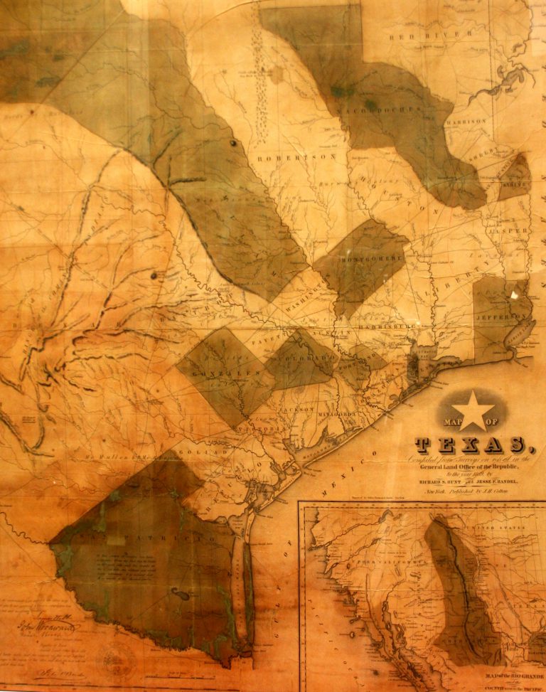
1839: Map of Texas
Cartography:
Richard A. Hunt
Richard A. Hunt
This map was published in 1839 by Richard A. Hunt and Jesse F. Randel in the first travel guide to … See more Map of Texas
17
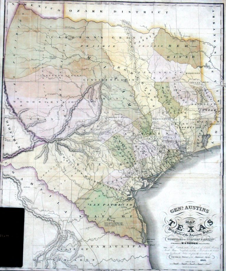
1840: General Austin’s Map of Texas with Parts of Adjoining States
Cartography:
Henry Schenck Tanner
Henry Schenck Tanner
In 1820, Moses Austin secured a land grant in Texas from the government of New Spain. However, prior to bringing … See more General Austin’s Map of Texas with Parts of Adjoining States
18
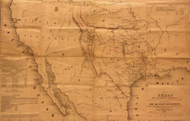
1844: Map of Texas and Countries Adjacent
Cartography:
William H. Emory
William H. Emory
In 1844, James K. Polk was elected to the office of the Presidency on the platform of “Manifest Destiny,” which … See more Map of Texas and Countries Adjacent
19
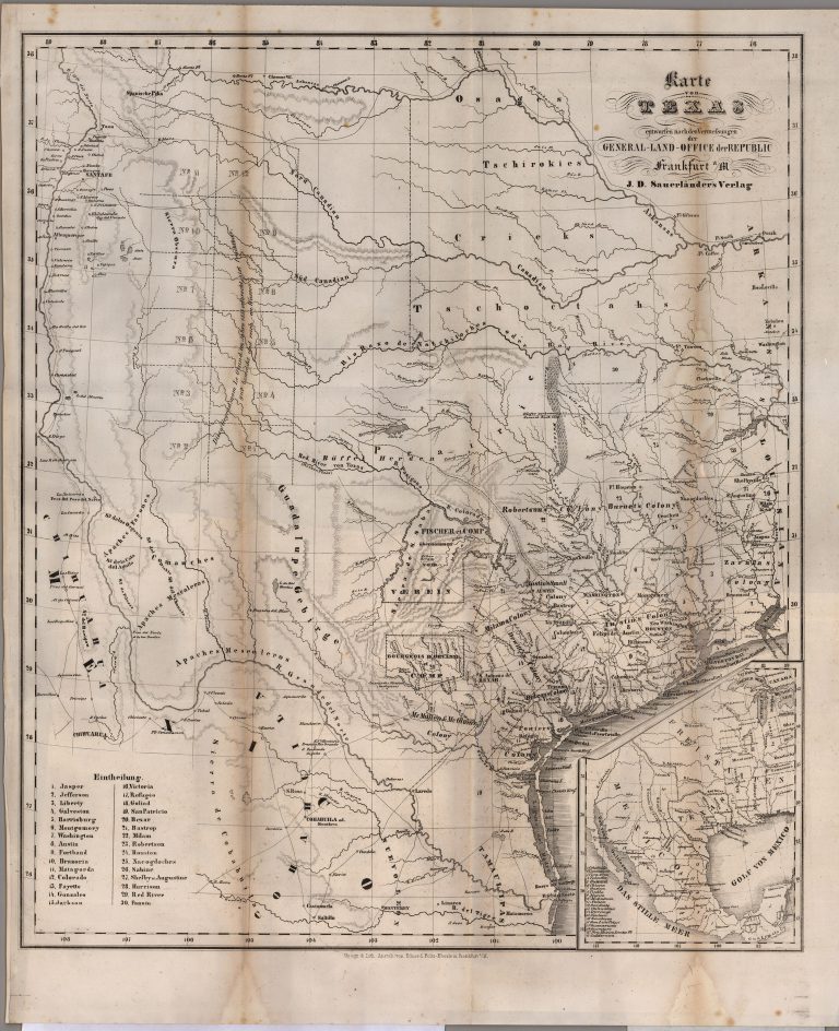
1845: Karte von Texas
Cartography:
Carl von Solms Braunfels
Carl von Solms Braunfels
This map of the Republic of Texas shows the land grants held by the “Adelsverein,” also known as the Society … See more Karte von Texas