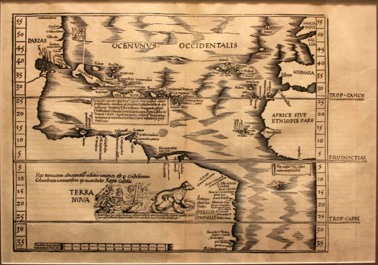
As far as Christopher Columbus was concerned, during his four voyages across the Atlantic Ocean, he never discovered New World, … See more Terra Nova
Geography: America (58 Maps)
Show Maps with Images Only2
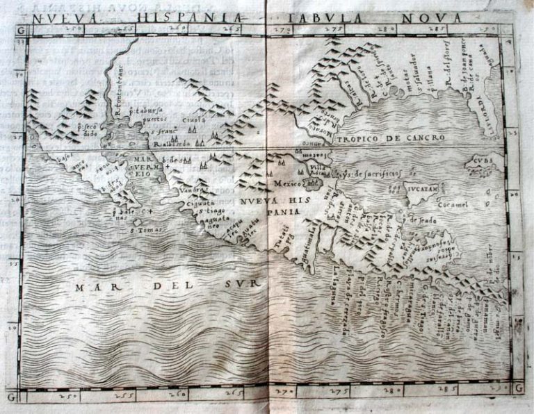
1548: Nueva Hispania Tabula Nova
Cartography:
Giacomo Gastaldi
Giacomo Gastaldi
Nueva Hispania – New Spain – was the first viceroyalty created to govern the Spanish-claimed territories in North America. Covering … See more Nueva Hispania Tabula Nova
3
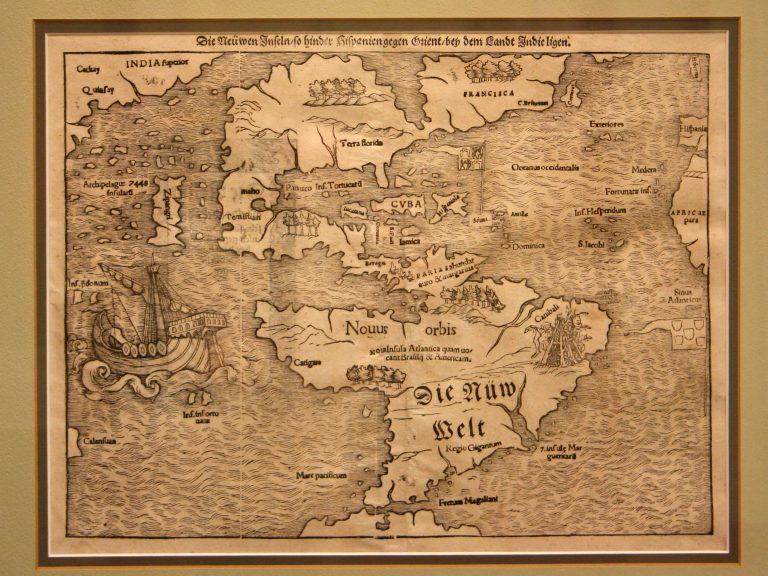
1550: Die Newwen Inselin
Cartography:
Sebastian Munster
Sebastian Munster
Printed from a woodcut, this map is the oldest one in the collection to show America surrounded by water on … See more Die Newwen Inselin
4
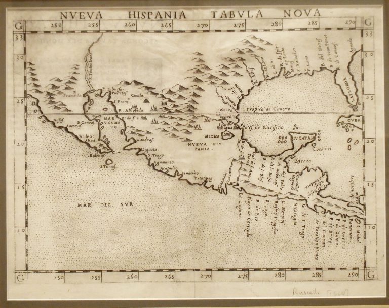
1561: Nueva Hispania Tabula Nova
Cartography:
Giralomo Ruscelli
Giralomo Ruscelli
This map is based on updated information provided by explorers Alonso Alvarez de Pineda and Cabeza de Vaca. It correctly … See more Nueva Hispania Tabula Nova
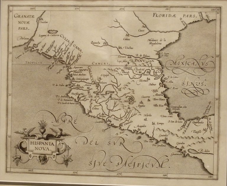
6
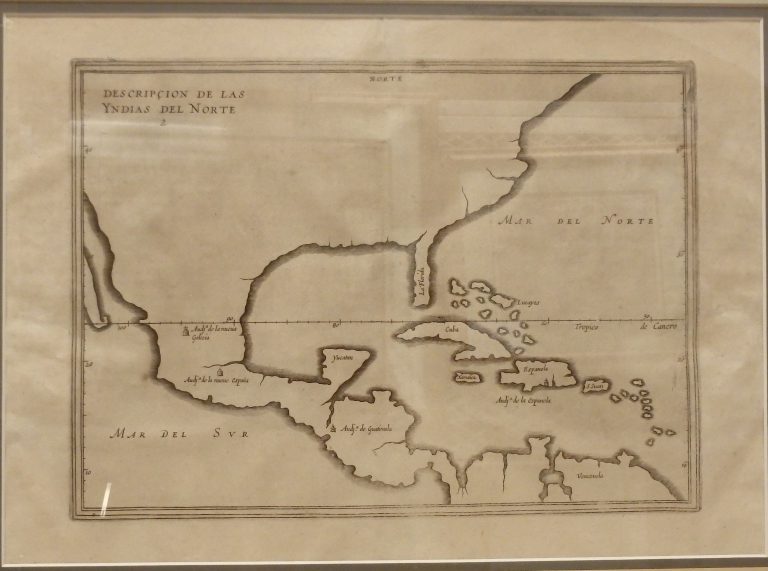
1601/1601: Descripcion de las Yndias del Norte
Cartography:
Antonio de Herrera
Antonio de Herrera
Antonio de Herrera was the historiographer and cartographer for King Phillip II of Spain, and this outline map of portions … See more Descripcion de las Yndias del Norte
7
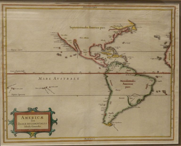
1630: Americae Sive Indiae Occidentalis Tabula Generalis
A very accurate coastline map for the period. De Laet, the Director of the Dutch West India Company, obviously had … See more Americae Sive Indiae Occidentalis Tabula Generalis
8
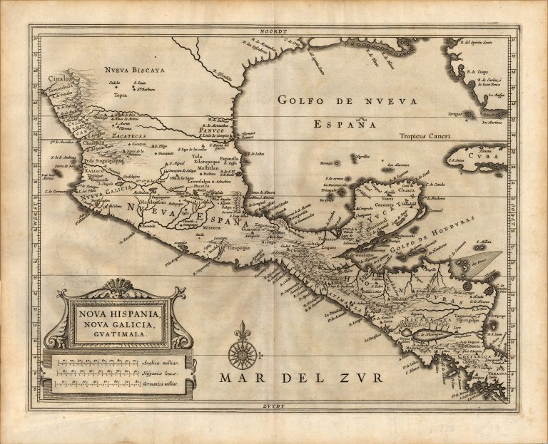
1640: Nova Hispania, Nova Galicia, Guatimala
Cartography:
Joannes De Laet
Joannes De Laet
This map was published by Dutch cartographer Joannes de Laet (1581-1649) in his History of the New World Atlas in 1640, … See more Nova Hispania, Nova Galicia, Guatimala
9
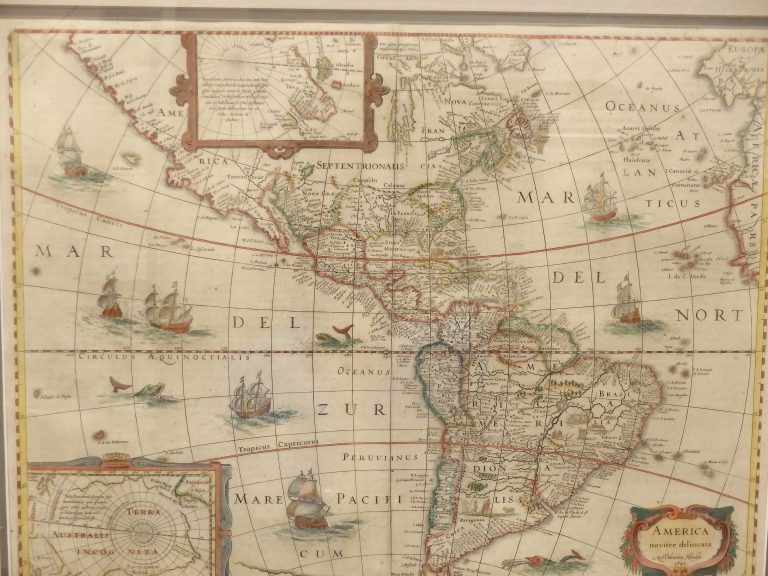
1641: America Noviter Delimeta
Cartography:
Jan Jansson
Jan Jansson
From their “Novi Atlantis” atlas, this map shows both polar regions, with sailing ships and sea monsters. Similar to Martin … See more America Noviter Delimeta
10
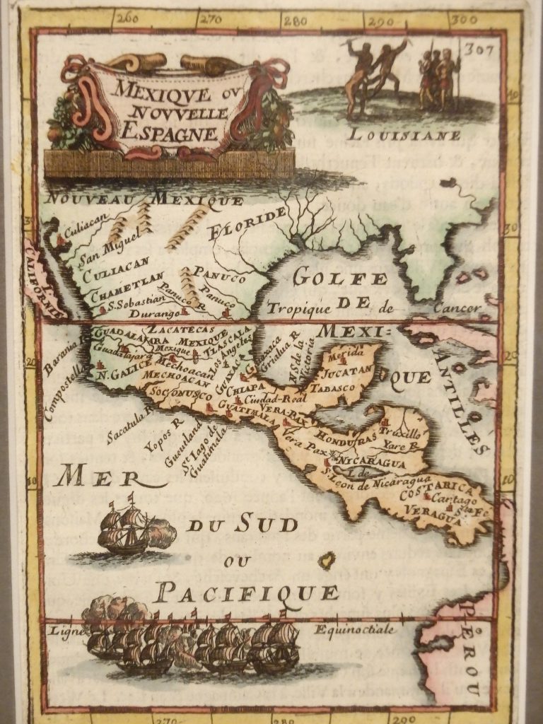
1683: De L’Amerique, Mexique ov Novelli Espagne
Cartography:
Alain Manesson Mallet
Alain Manesson Mallet
Alain Manesson Mallet 1630-1706) was a French cartographer who served as a Sergent-Major of artillery in the army of King … See more De L’Amerique, Mexique ov Novelli Espagne