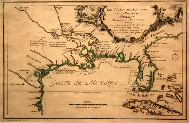
This map is based on the explorations of Pierre de La Moyne d’Iberville, the founder of Louisiana and one of … See more Les Costes Aux Environs De La Riviere De Misisipi
Geography: Texas (6 Maps with Images)
Show All Maps2
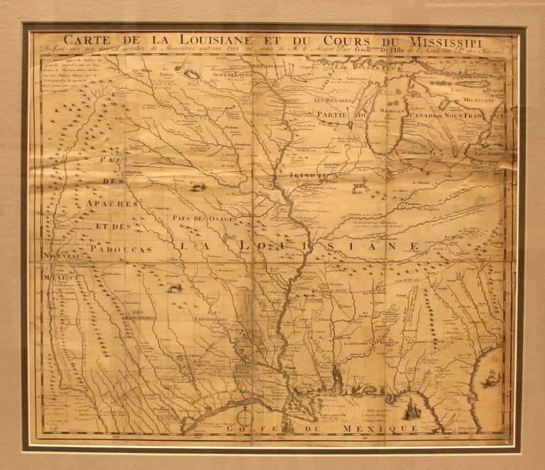
1718/1735: Carte de la Louisiane et du Cours du Mississipi
Cartography:
Jean Frederick Bernard
Jean Frederick Bernard
This is the first map to have a reference to TEXAS on it. Based on Del’Isle’s 1718 map, it shows … See more Carte de la Louisiane et du Cours du Mississipi
3
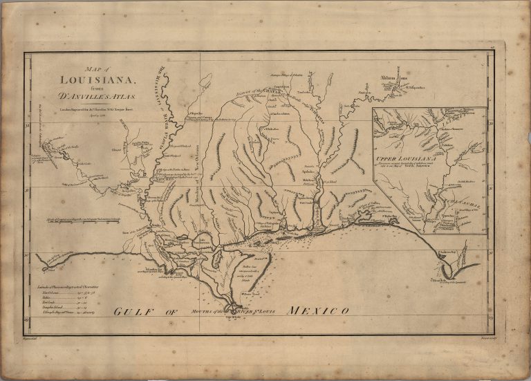
1756/1791: Map of Louisiana
Cartography:
Jean Baptiste Bourguignon d'Anville
Jean Baptiste Bourguignon d'Anville
The original map by Jean Baptiste Bourguignon d’Anville was published in 1756. It clearly identifies the location of Los Adaes … See more Map of Louisiana
4
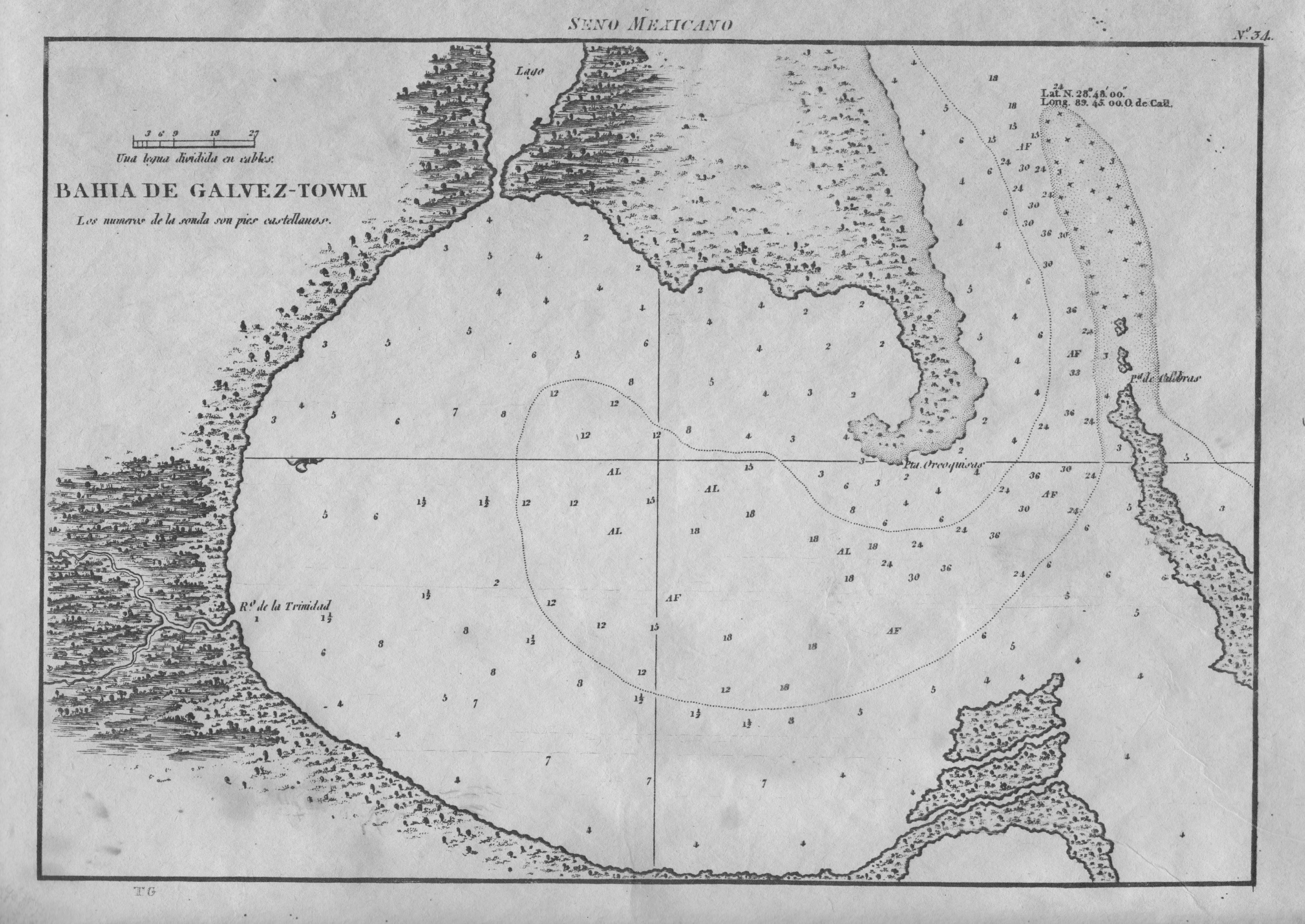
1809: Bahia de Galvez-Towm
Cartography:
Jose de Evia
Jose de Evia
Spanish naval chart, and the first map devoted specifically to Galveston Bay. It is based on Jose de Evia’s 1783-86 … See more Bahia de Galvez-Towm
5
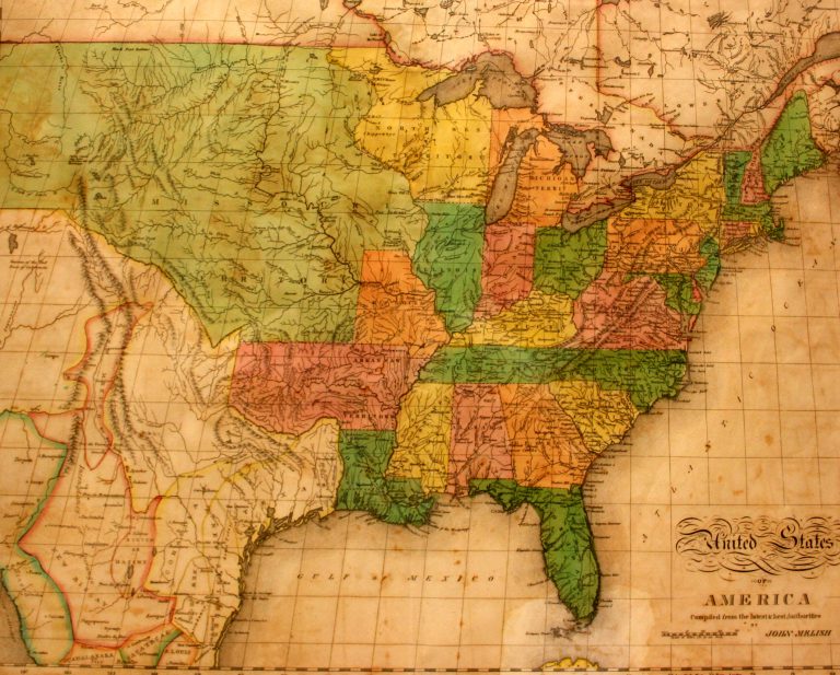
1822: United States of America
Cartography:
John Melish
John Melish
This is the first map in the collection at the Museum of the Big Bend to show Texas as a … See more United States of America