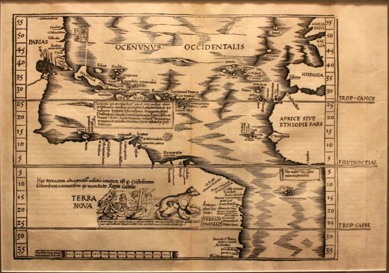
As far as Christopher Columbus was concerned, during his four voyages across the Atlantic Ocean, he never discovered New World, … See more Terra Nova
Theme: Discovery (20 Maps)
Show Maps with Images Only2
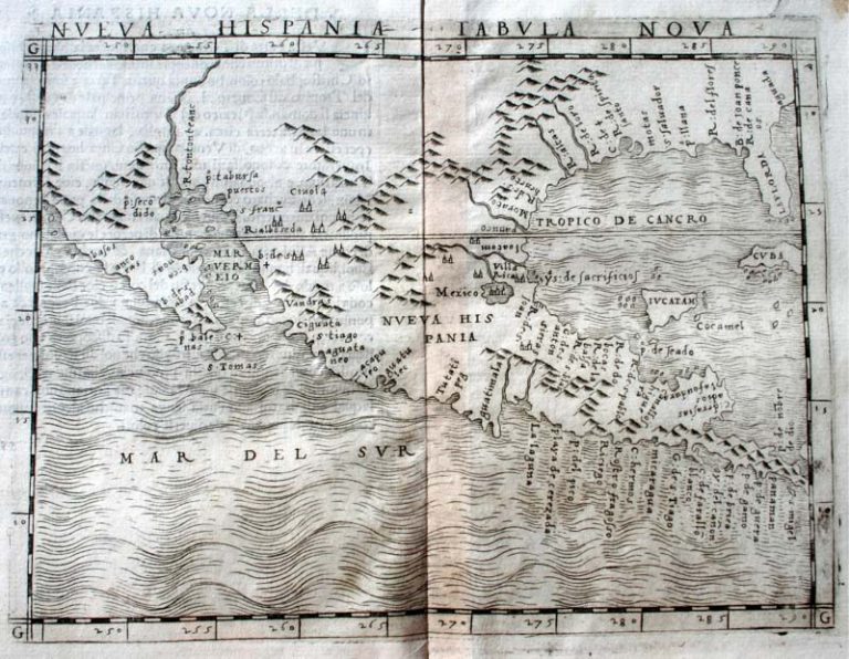
1548: Nueva Hispania Tabula Nova
Cartography:
Giacomo Gastaldi
Giacomo Gastaldi
Nueva Hispania – New Spain – was the first viceroyalty created to govern the Spanish-claimed territories in North America. Covering … See more Nueva Hispania Tabula Nova
4
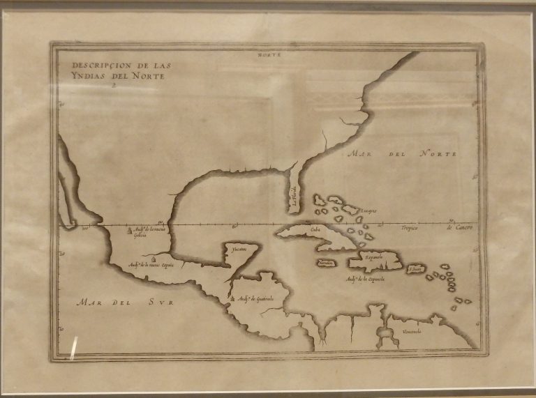
1601/1601: Descripcion de las Yndias del Norte
Cartography:
Antonio de Herrera
Antonio de Herrera
Antonio de Herrera was the historiographer and cartographer for King Phillip II of Spain, and this outline map of portions … See more Descripcion de las Yndias del Norte
5
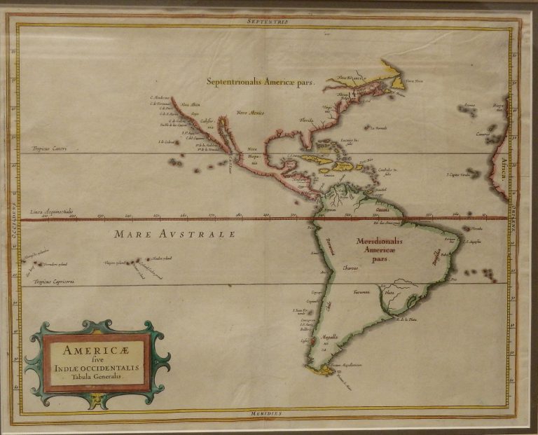
1630: Americae Sive Indiae Occidentalis Tabula Generalis
A very accurate coastline map for the period. De Laet, the Director of the Dutch West India Company, obviously had … See more Americae Sive Indiae Occidentalis Tabula Generalis
6
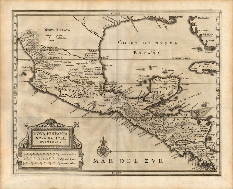
1640: Nova Hispania, Nova Galicia, Guatimala
Cartography:
Joannes De Laet
Joannes De Laet
This map was published by Dutch cartographer Joannes de Laet (1581-1649) in his History of the New World Atlas in 1640, … See more Nova Hispania, Nova Galicia, Guatimala
7
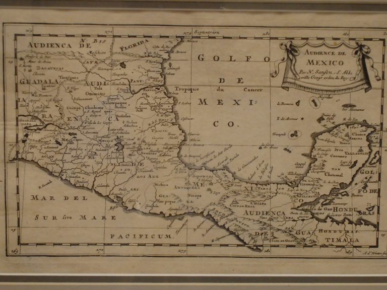
1662: Audience de Mexico
Cartography:
Nicolas d'Abbeville Sanson
Nicolas d'Abbeville Sanson
One of the earliest regional maps of Mexico, including the Yucatan and part of Central America. From the 1662 edition … See more Audience de Mexico
8
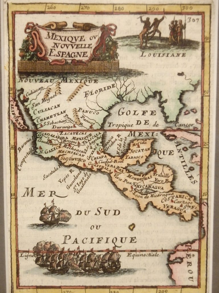
1683: De L’Amerique, Mexique ov Novelli Espagne
Cartography:
Alain Manesson Mallet
Alain Manesson Mallet
Alain Manesson Mallet 1630-1706) was a French cartographer who served as a Sergent-Major of artillery in the army of King … See more De L’Amerique, Mexique ov Novelli Espagne
9
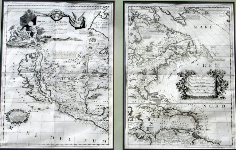
1688: America Settentrionale
Cartography:
Vincenzo Maria Coronelli
Vincenzo Maria Coronelli
This was one of the most influential maps of North America published in the late 17th Century. Coronelli was a … See more America Settentrionale
10
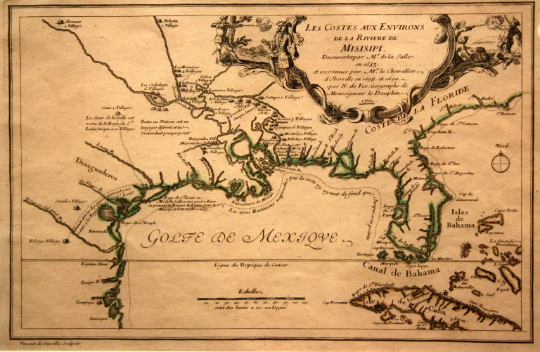
1701: Les Costes Aux Environs De La Riviere De Misisipi
Cartography:
Nicolas de Fer
Nicolas de Fer
This map is based on the explorations of Pierre de La Moyne d’Iberville, the founder of Louisiana and one of … See more Les Costes Aux Environs De La Riviere De Misisipi