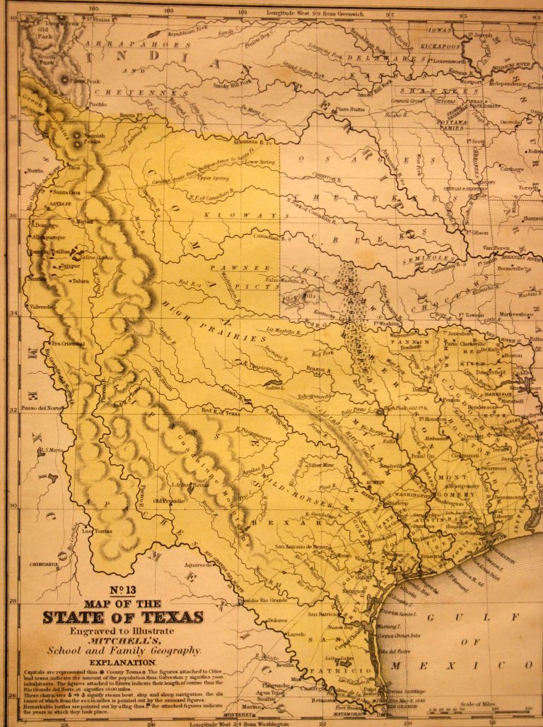
On 29 December 1845, the U.S. Congress admitted Texas as the 28th state of the United States, and this 1846 … See more Map of the State of Texas, No. 13
Geography: Texas (10 Maps with Images)
Show All Maps22
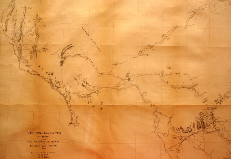
1849: Reconnaissances of Routes From San Antonio de Bexar to El Paso del Norte
Cartography:
Joseph E. Johnston
Joseph E. Johnston
While the Treaty of Guadalupe-Hidalgo was being negotiated in February of 1948, formally bringing an end to the U.S.-Mexico War, … See more Reconnaissances of Routes From San Antonio de Bexar to El Paso del Norte
23
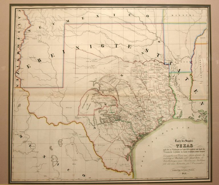
1851: Karte des Staates Texas
Cartography:
Verein zum Schutzer Deustcher
Verein zum Schutzer Deustcher
Map published by the German Emigrant’s Association (Verein) in a guidebook to prospective emigrants planning on relocating to Texas. The primary … See more Karte des Staates Texas
24
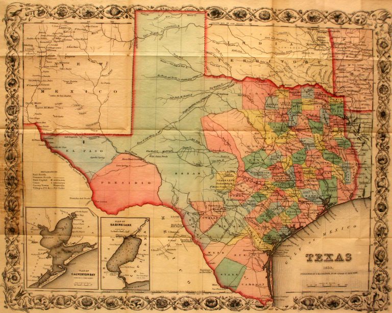
1853: Texas
Cartography:
Joseph Hutchins Colton
Joseph Hutchins Colton
This is the first pocket map of Texas following the Compromise of 1850. Designed to be folded up into its … See more Texas
25
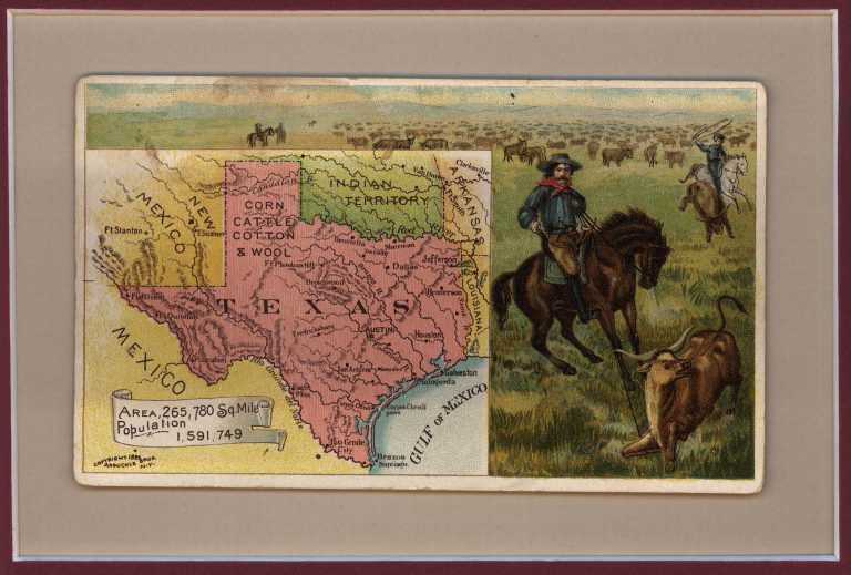
1889: Postcard Map of Texas, New Mexico, and Indian Territory
Cartography:
Arbuckle Brothers Coffee
Arbuckle Brothers Coffee
Pittsburgh grocers John and Charles Arbuckle patented a method for roasting coffee involving coating beans with a glaze of egg … See more Postcard Map of Texas, New Mexico, and Indian Territory
26
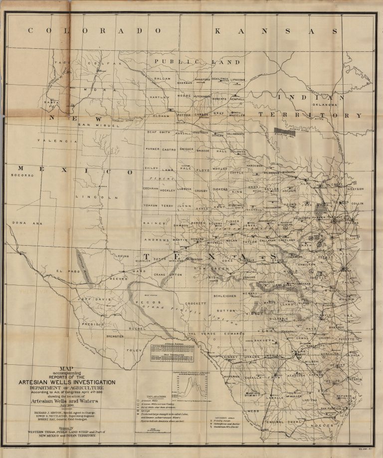
1890: Map Accompanying Reports of the Artesian Wells Investigation
Cartography:
Richard J. Hinton
Richard J. Hinton
Groundwater trapped below rock strata was essential to the development of the arid regions of the American West. This government-published … See more Map Accompanying Reports of the Artesian Wells Investigation
27
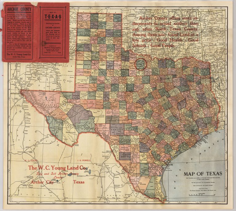
1910: Map of Texas
Cartography:
Kenyon Printing Company
Kenyon Printing Company
A pocket map of Texas, with the cover and overprint in red advertising Archer County, Texas, as the “cheapest good … See more Map of Texas
28
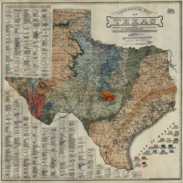
1920: Geological Map of Texas Showing Approximate Locations and Drilling Wells, also Names of Companies Drilling
Cartography:
Standard Blue Print Map and Engineering Company
Standard Blue Print Map and Engineering Company
Oil in Texas was first noted by the 1543 DeSoto expedition, and commercial production began in Corsicana (Navarro County) in … See more Geological Map of Texas Showing Approximate Locations and Drilling Wells, also Names of Companies Drilling
29
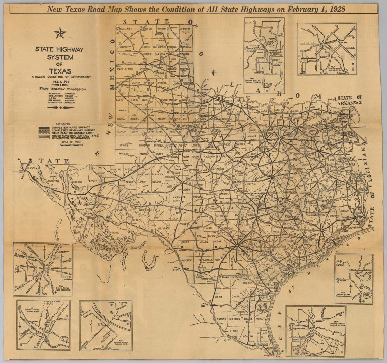
1928: State Highway System of Texas
Cartography:
Dallas Morning News
Dallas Morning News
No coordinated transportation system existed in Texas until the advent of the automobile at the beginning of the 20th century. … See more State Highway System of Texas
30
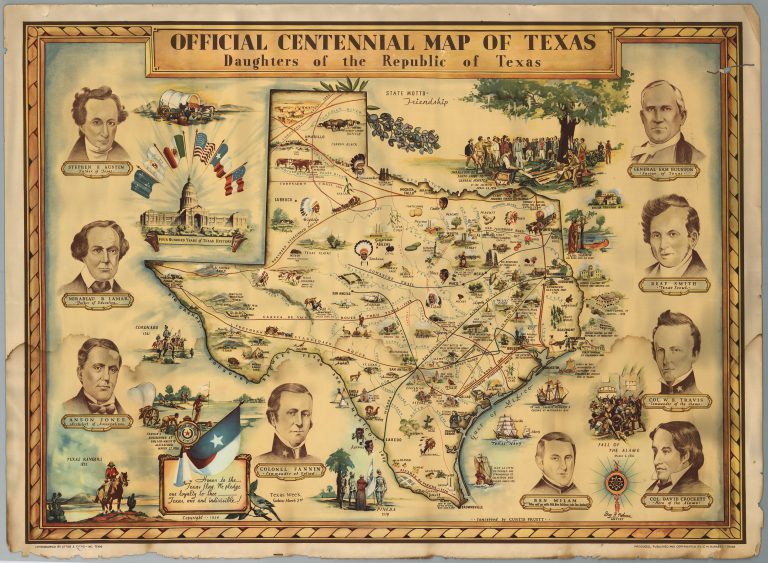
1934: Official Centennial Map of Texas
Cartography:
Curtis Pruett
Curtis Pruett
This map was commissioned by the Daughters of the Republic of Texas to commemorate the anniversary of the state’s revolution, … See more Official Centennial Map of Texas