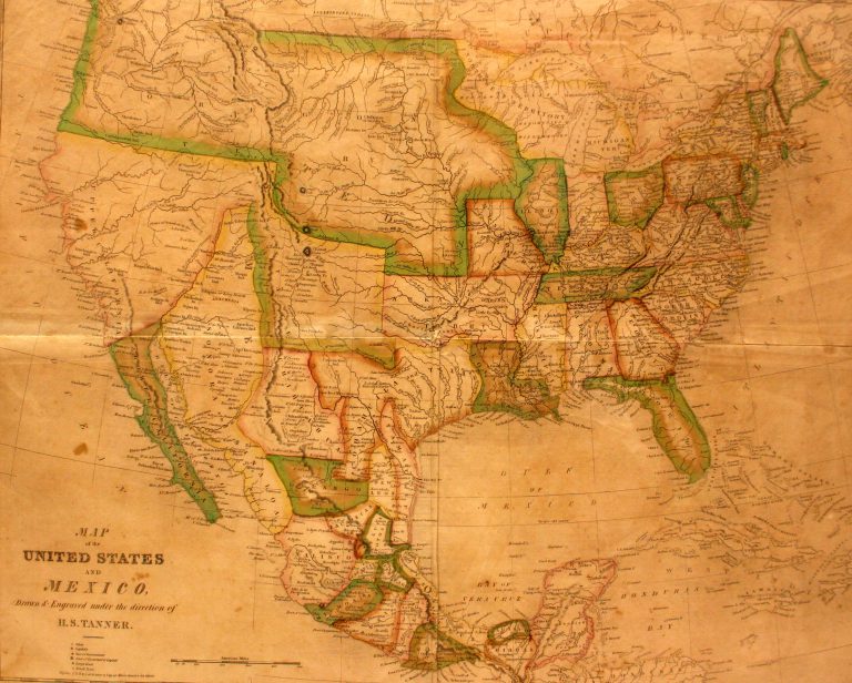
In 1824, Mexico passed a new constitution which combined the two states of Texas and Coahuila, and this is the … See more Smiley’s Geography Atlas map of the United States and Mexico
Henry Schenck Tanner (3 Maps with Images)
Show All Maps2
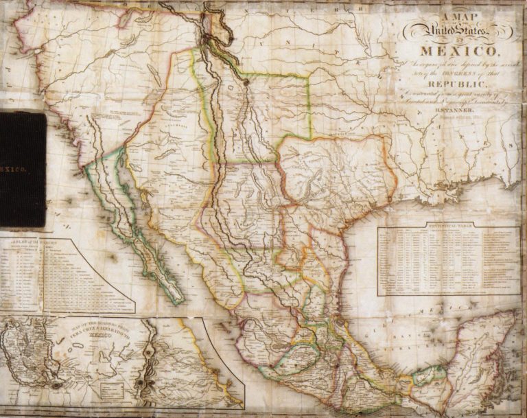
1834: Map of the United States of Mexico as Organized and Defined by the Congress of that Republic
Cartography:
Henry Schenck Tanner
Henry Schenck Tanner
This large pocket map includes two insets, a) Table of Distances and b) Map of the Roads from Vera Cruz … See more Map of the United States of Mexico as Organized and Defined by the Congress of that Republic
3
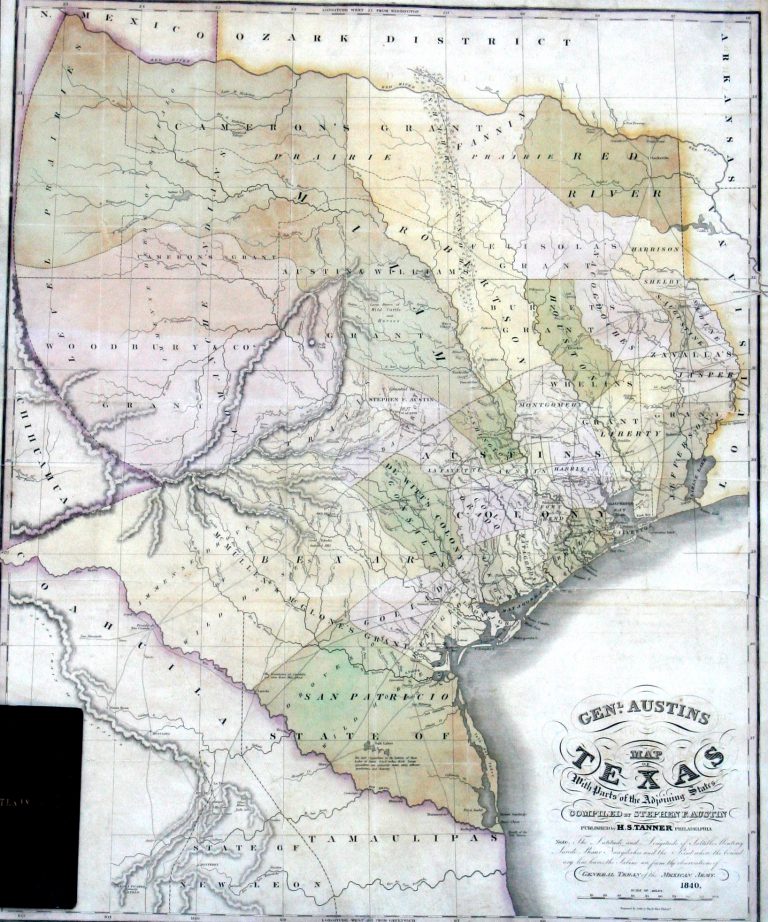
1840: General Austin’s Map of Texas with Parts of Adjoining States
Cartography:
Henry Schenck Tanner
Henry Schenck Tanner
In 1820, Moses Austin secured a land grant in Texas from the government of New Spain. However, prior to bringing … See more General Austin’s Map of Texas with Parts of Adjoining States