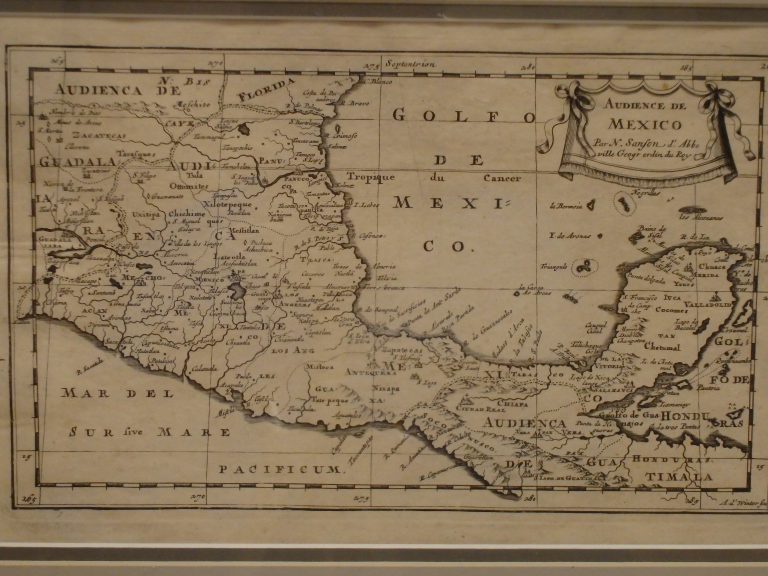
One of the earliest regional maps of Mexico, including the Yucatan and part of Central America. From the 1662 edition … See more Audience de Mexico
Geography: Mexico (39 Maps)
Show Maps with Images Only3
1747: A New and Accurate Map of Mexico or New Spain Together with California
Cartography:
Emmanuel Bowen
Emmanuel Bowen
This map includes an inset of “The Gallipago Islands Discovered and Described by Captain Cowley in 1864.” The cartouche shows … See more A New and Accurate Map of Mexico or New Spain Together with California
6
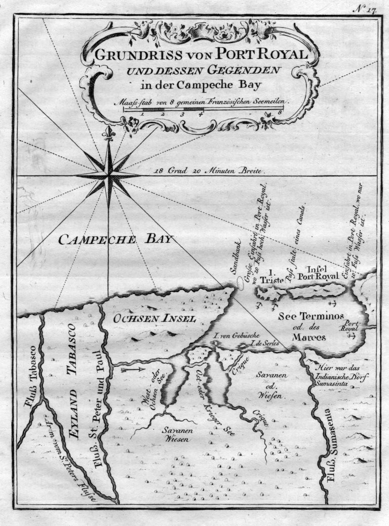
1756: Grundriss von Port Royal und dessen Gegenden in der Campeche Bay
Cartography:
Jacques Bellin
Jacques Bellin
A map of the Bay of Campeche, in Mexico, published in 1756. The Island of Port Royal is today known … See more Grundriss von Port Royal und dessen Gegenden in der Campeche Bay
10
1780: Le Nouveau Mexique
Cartography:
Bonne Rigobert
Bonne Rigobert
This map shows excellent detail for the time in Texas, Arizona and New Mexico, but a badly misprojected Baja California, which … See more Le Nouveau Mexique