Moll’s map of New France. The map provides an especially detailed look at the regions between the Appalachians and the … See more A Map of New France Containing Canada, Louisiana, in North America
Theme: Political (56 Maps)
Show Maps with Images Only3
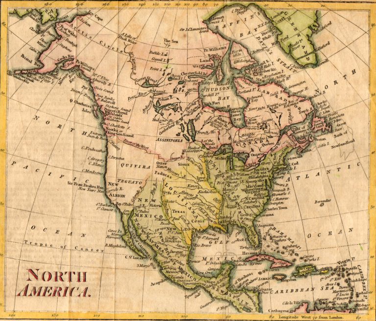
1785: North America
Cartography:
Thomas Kitchin
Thomas Kitchin
This is the first map to use the current spelling of TEXAS. Note that it shows Texas as part of … See more North America
4
1785: Atlante Nouissimo
Cartography:
Antonio Zatta
Antonio Zatta
A decorative and highly detailed map of Mexico, Central America and the southern half of the United States. Excellent detail … See more Atlante Nouissimo
7
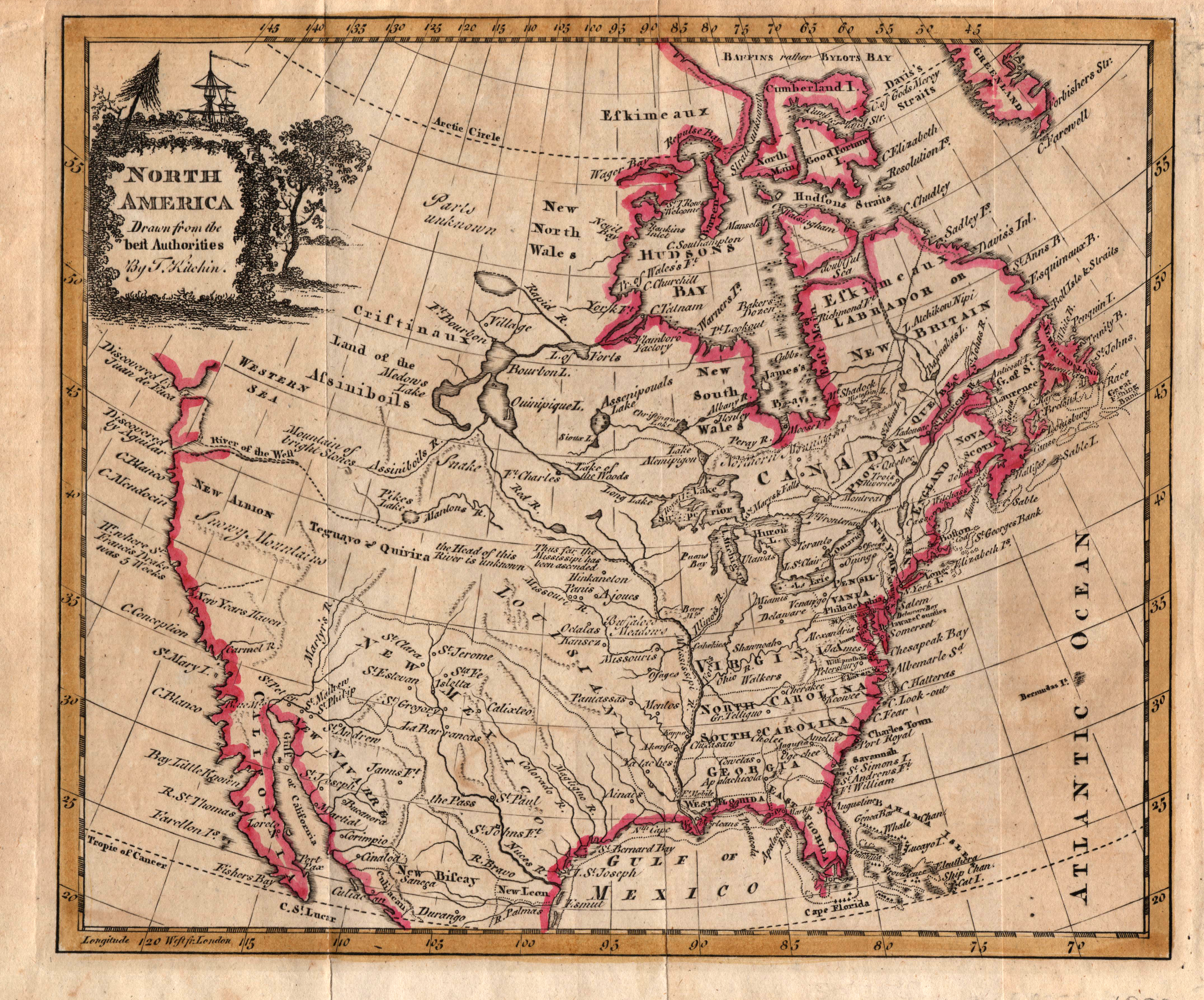
1808: North America, drawn from the Best Authorities
Cartography:
Thomas Kitchin
Thomas Kitchin
An early map of North America with the new states of the United States and the British provinces and colonies … See more North America, drawn from the Best Authorities
10
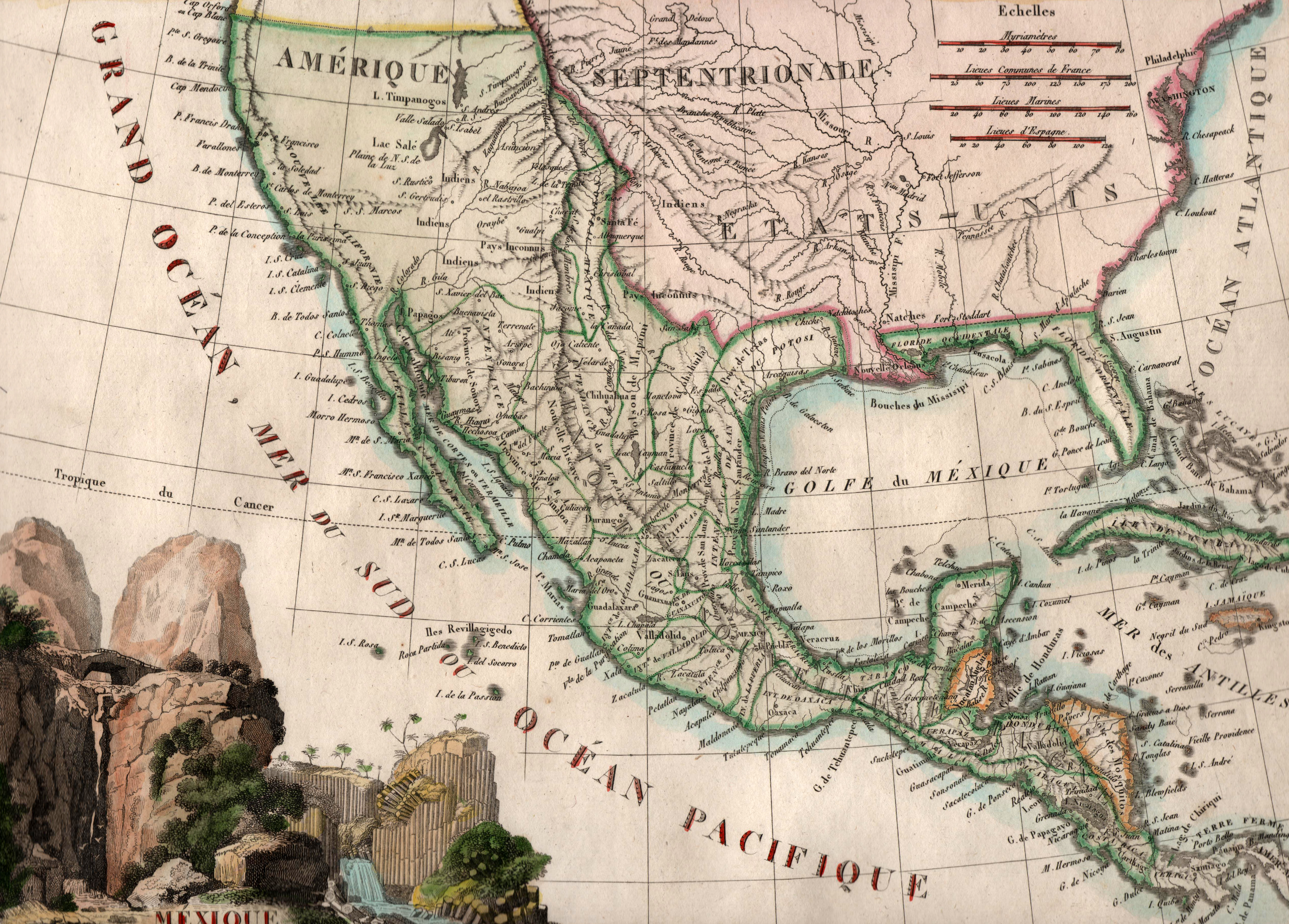
1812: Mexique
Cartography:
J. B. Tardieu
J. B. Tardieu
Printed by French cartographer J. B. Tardieu in 1812, just two years after independence was declared from Spain, this map … See more Mexique