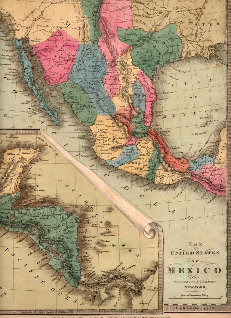
An interesting map by American cartographer David Burr, showing the Mexican state of TEXAS, with its border with Coahuila located … See more The United States of Mexico
Maps w/ Images Only
Date
- 1525(1)
- 1548(1)
- 1550(1)
- 1561(1)
- 1584(1)
- 1596(1)
- 1597(1)
- 1601(1)
- 1601(1)
- 1630(1)
- 1640(1)
- 1641(1)
- 1662(1)
- 1683(1)
- 1688(1)
- 1701(1)
- 1703(1)
- 1705(2)
- 1708(1)
- 1715(1)
- 1718(1)
- 1719(1)
- 1723(1)
- 1725(1)
- 1734(1)
- 1735(1)
- 1735(1)
- 1745(2)
- 1746(1)
- 1747(1)
- 1749(1)
- 1750(1)
- 1753(1)
- 1754(1)
- 1756(4)
- 1757(2)
- 1764(1)
- 1775(2)
- 1780(2)
- 1783(1)
- 1785(2)
- 1788(1)
- 1791(1)
- 1793(1)
- 1794(1)
- 1795(2)
- 1803(1)
- 1804(1)
- 1807(2)
- 1808(2)
- 1809(1)
- 1811(2)
- 1812(4)
- 1816(2)
- 1817(1)
- 1820(2)
- 1821(1)
- 1822(1)
- 1823(2)
- 1824(1)
- 1825(2)
- 1826(4)
- 1827(10)
- 1828(1)
- 1829(4)
- 1830(1)
- 1832(5)
- 1833(1)
- 1834(3)
- 1835(1)
- 1835(8)
- 1836(1)
- 1837(1)
- 1839(1)
- 1840(1)
- 1844(2)
- 1845(2)
- 1846(1)
- 1847(1)
- 1848(1)
- 1849(4)
- 1850(1)
- 1851(1)
- 1853(1)
- 1857(3)
- 1863(1)
- 1864(1)
- 1879(1)
- 1886(2)
- 1889(1)
- 1890(1)
- 1892(1)
- 1905(1)
- 1910(1)
- 1911(1)
- 1914(1)
- 1918(1)
- 1920(1)
- 1928(1)
- 1934(1)
- 1935(1)