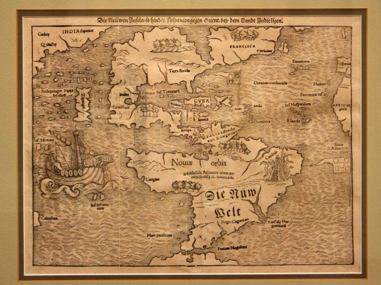
Printed from a woodcut, this map is the oldest one in the collection to show America surrounded by water on … See more Die Newwen Inselin
Theme: Exploration (29 Maps)
Show Maps with Images Only2
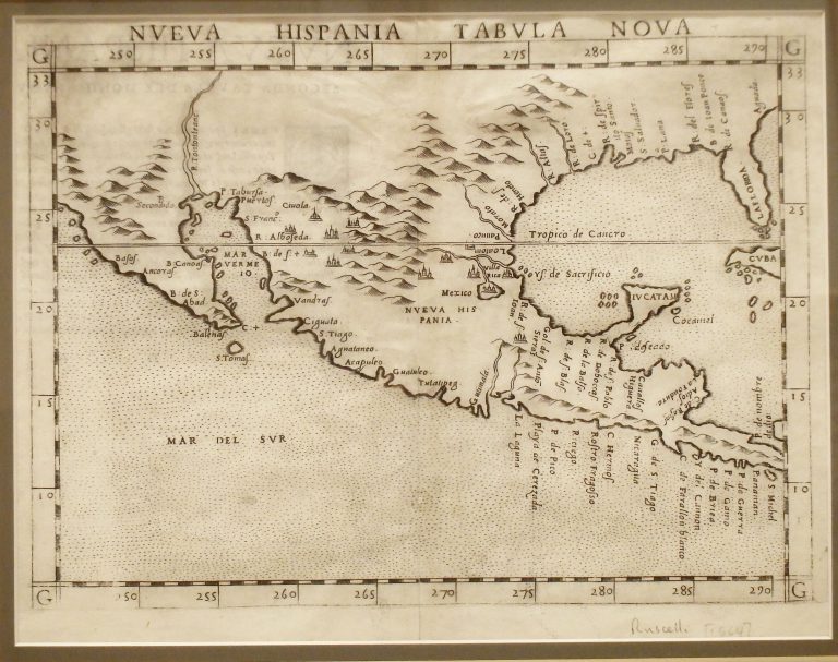
1561: Nueva Hispania Tabula Nova
Cartography:
Giralomo Ruscelli
Giralomo Ruscelli
This map is based on updated information provided by explorers Alonso Alvarez de Pineda and Cabeza de Vaca. It correctly … See more Nueva Hispania Tabula Nova
3
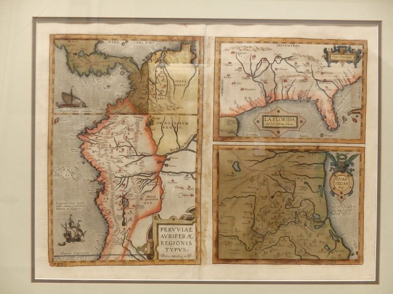
1584: La Florida. Auctore Hieron. Chiasues. Gwastecan Reg. Peruviae.
Cartography:
H. Chaves
H. Chaves
Three-panel map showing some of the regions in the New World claimed by Spain, including Peru, Guatemala, and the Gulf … See more La Florida. Auctore Hieron. Chiasues. Gwastecan Reg. Peruviae.
4
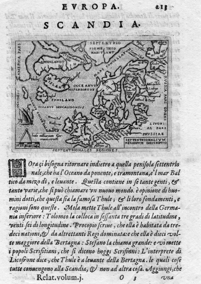
1596: Europa: Scandia
Cartography:
Giovanni Antonio Magini
Giovanni Antonio Magini
Italian cartographer and astronomer Giovanni Antonio Magini printed this map of Europe in his 1596 update of Ptolemy’s Geographia atlas. Magini based … See more Europa: Scandia
5
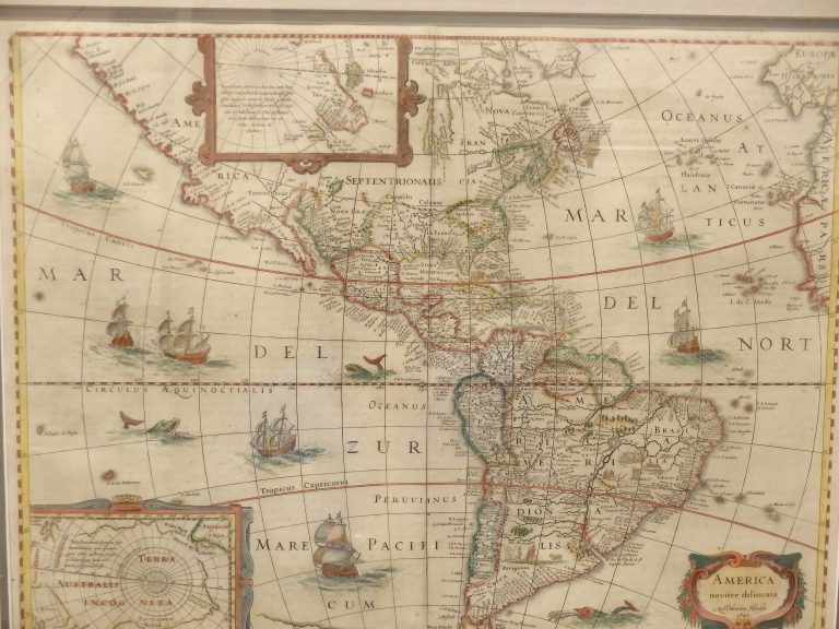
1641: America Noviter Delimeta
Cartography:
Jan Jansson
Jan Jansson
From their “Novi Atlantis” atlas, this map shows both polar regions, with sailing ships and sea monsters. Similar to Martin … See more America Noviter Delimeta
6
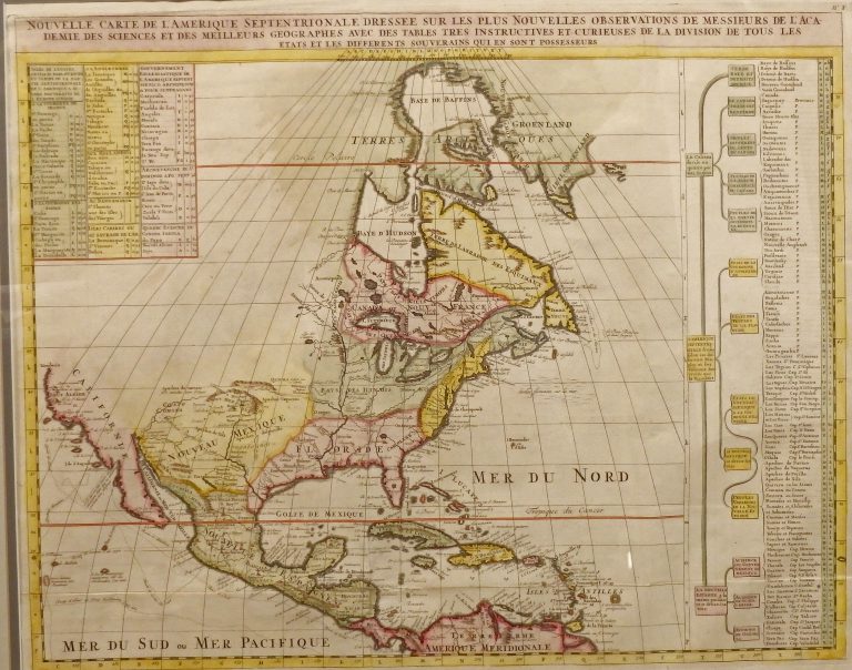
1705: Nouvelle Carte de L’Amerique Septentrionale
Cartography:
Henri Chatelain
Henri Chatelain
Published by Chatelain in Amsterdam in the 1705 edition of his Atlas Historique. Shows some of the first correct depictions … See more Nouvelle Carte de L’Amerique Septentrionale
7
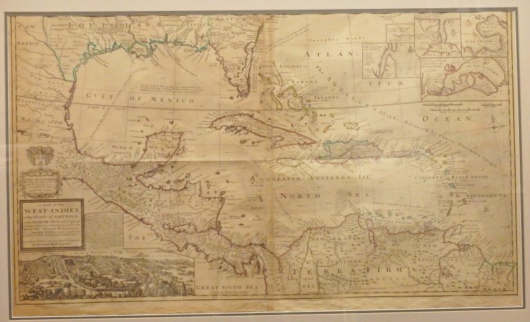
1715: A Map of the West Indies or the Islands of America in the North Sea, with ye adjacent Countries
Cartography:
Herman Moll
Herman Moll
One of the most remarkable maps of the West Indies to appear in the 18th Century. In addition to showing … See more A Map of the West Indies or the Islands of America in the North Sea, with ye adjacent Countries
8
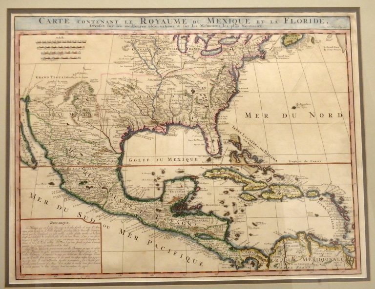
1719: Carte Contenant Le Royaume Du Mexique Et La Floride
Cartography:
Henri Chatelain
Henri Chatelain
This 1719 map by Dutch cartographer Henri Chatelain, covering the southern portion of North America, was basically an updated map … See more Carte Contenant Le Royaume Du Mexique Et La Floride
9
1725: Mississippi Seu Provinciae Ludovicianae
Cartography:
Johann Baptista Homann
Johann Baptista Homann
Striking example of Homann’s map of the Course of the Mississipp River, based upon the reports of Hennepin, who explored … See more Mississippi Seu Provinciae Ludovicianae