Eastern section of a pair of maps covering the territory of the new United States. This section covers the eastern … See more Etats Unis De L’Amerique
Theme: Settlement (5 Maps)
Show Maps with Images Only2
1783: Map of the European Settlements in Mexico or New Spain and the West Indies
Cartography:
Thomas Kitchin
Thomas Kitchin
The focus of this map is Mexico, Central America, and the Caribbean, though it extends into North America as far … See more Map of the European Settlements in Mexico or New Spain and the West Indies
4
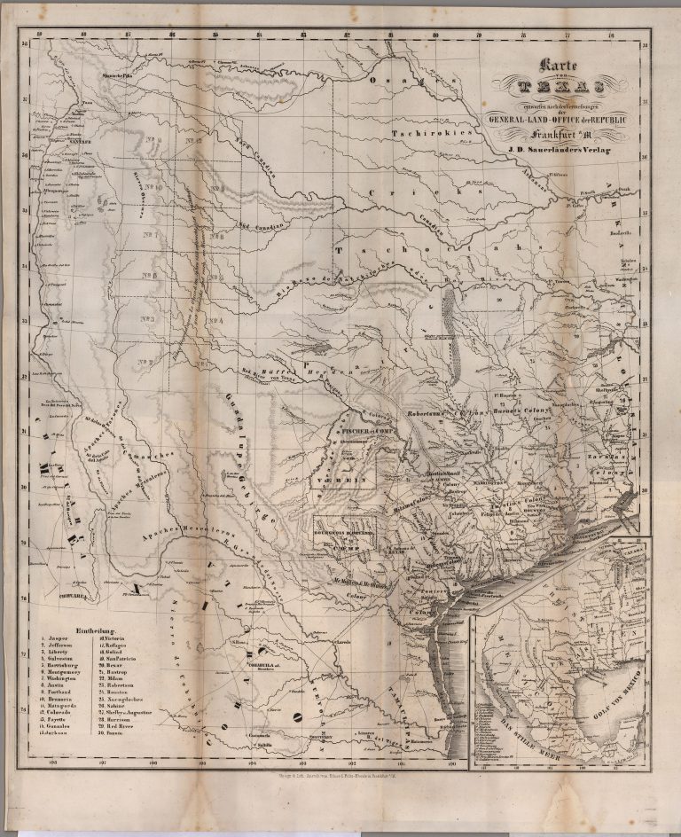
1845: Karte von Texas
Cartography:
Carl von Solms Braunfels
Carl von Solms Braunfels
This map of the Republic of Texas shows the land grants held by the “Adelsverein,” also known as the Society … See more Karte von Texas
5
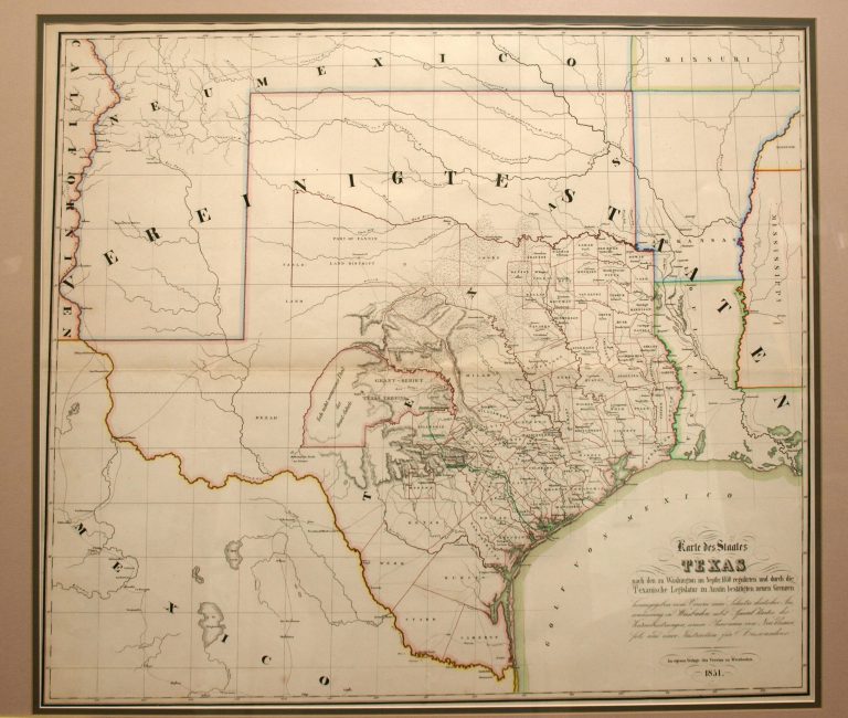
1851: Karte des Staates Texas
Cartography:
Verein zum Schutzer Deustcher
Verein zum Schutzer Deustcher
Map published by the German Emigrant’s Association (Verein) in a guidebook to prospective emigrants planning on relocating to Texas. The primary … See more Karte des Staates Texas