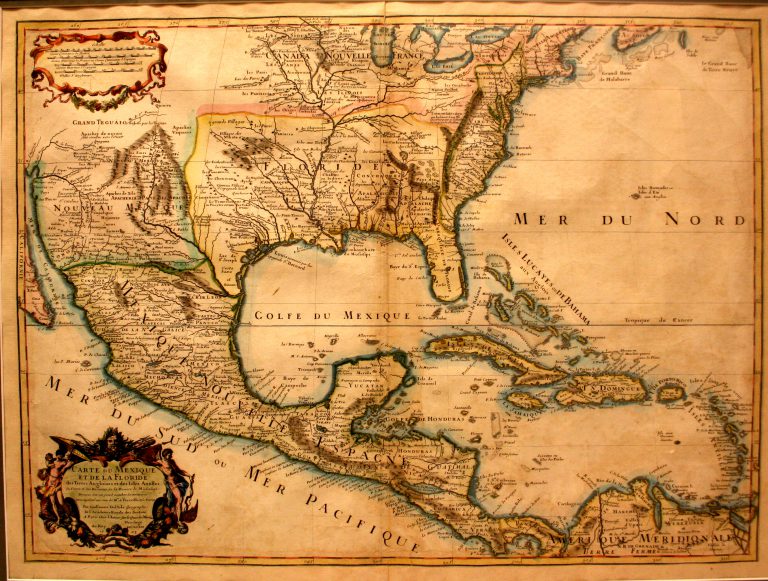
This map, by French cartographer Guillaume Del’Isle (1675-1726), shows both the Mississippi River and the Rio Grande, thus making it … See more Carte du Mexique et de la Floride
Theme: Discovery (20 Maps)
Show Maps with Images Only12
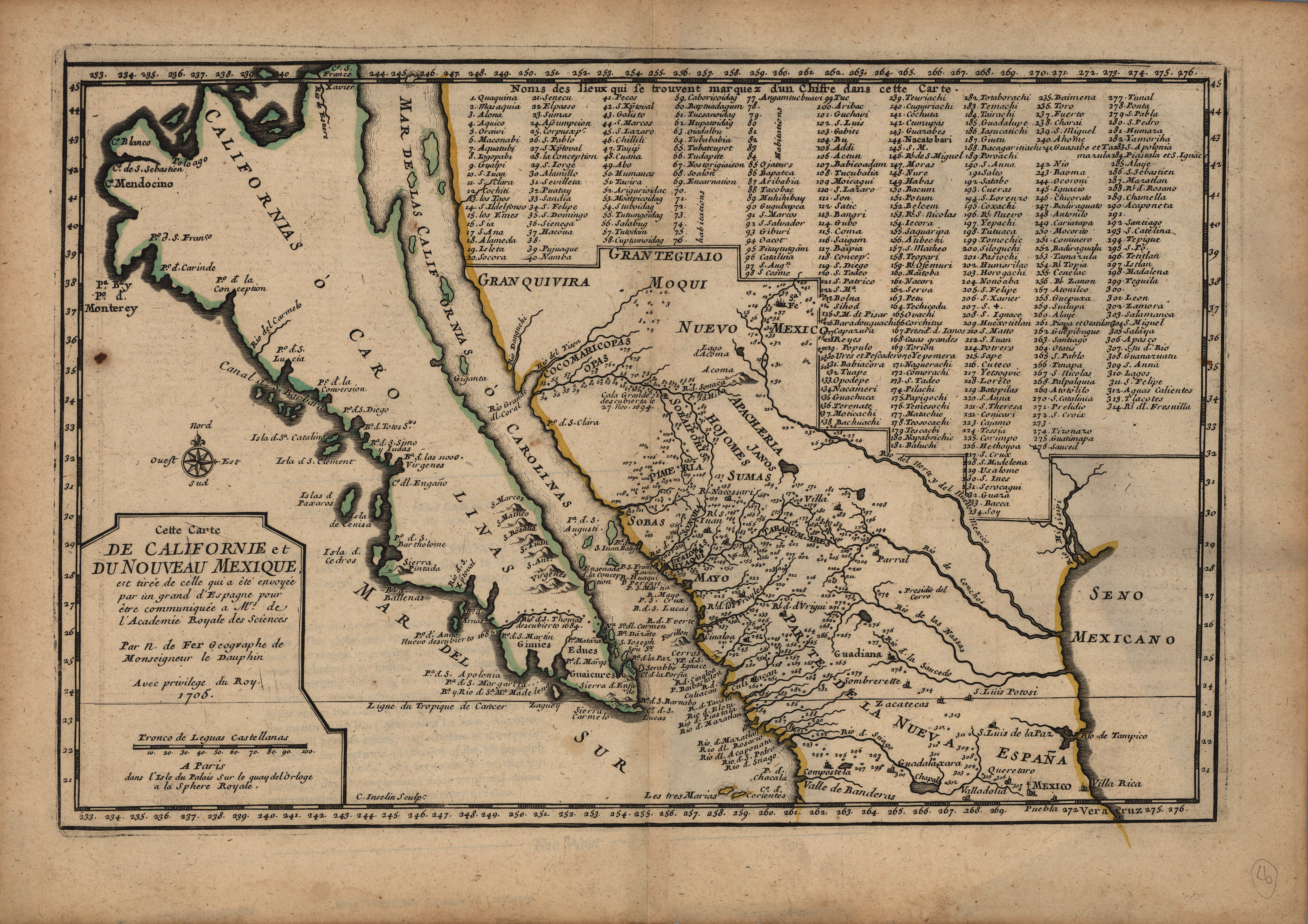
1705: Carte de Californie et du Nouveau Mexique
Cartography:
Nicolas de Fer
Nicolas de Fer
Copper engraved in Paris in 1705 and published in De Fer’s L’Atlas Curieux, this map is based on the explorations … See more Carte de Californie et du Nouveau Mexique
13
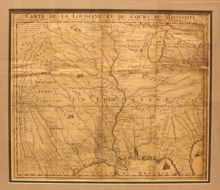
1718/1735: Carte de la Louisiane et du Cours du Mississipi
Cartography:
Jean Frederick Bernard
Jean Frederick Bernard
This is the first map to have a reference to TEXAS on it. Based on Del’Isle’s 1718 map, it shows … See more Carte de la Louisiane et du Cours du Mississipi
14
1747: A New and Accurate Map of Mexico or New Spain Together with California
Cartography:
Emmanuel Bowen
Emmanuel Bowen
This map includes an inset of “The Gallipago Islands Discovered and Described by Captain Cowley in 1864.” The cartouche shows … See more A New and Accurate Map of Mexico or New Spain Together with California
16
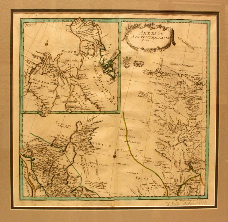
1753: Americae Septentrionalis, Pars 1
Cartography:
Leonhard Von Euler
Leonhard Von Euler
This 1753 map, by Swiss mathematician Leonhard Von Euler, is the first map to show Texas (Tecas) as a region, … See more Americae Septentrionalis, Pars 1
17
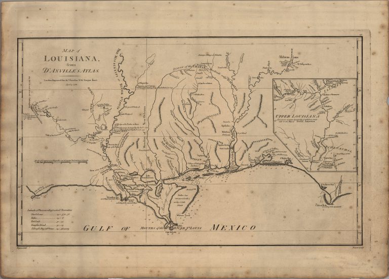
1756/1791: Map of Louisiana
Cartography:
Jean Baptiste Bourguignon d'Anville
Jean Baptiste Bourguignon d'Anville
The original map by Jean Baptiste Bourguignon d’Anville was published in 1756. It clearly identifies the location of Los Adaes … See more Map of Louisiana
18
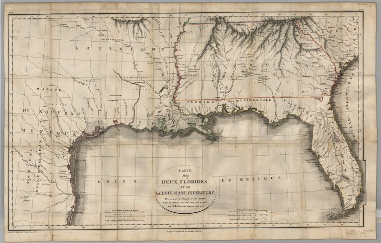
1807: Carte des Deux Florides et de La Louisiane Inferieure
Cartography:
Jean Baptiste Poirson
Jean Baptiste Poirson
The Texas provincial cities of St. Antoine de Bexar and Nacogcoches are located on this map. The Gulf Coast, according … See more Carte des Deux Florides et de La Louisiane Inferieure
19
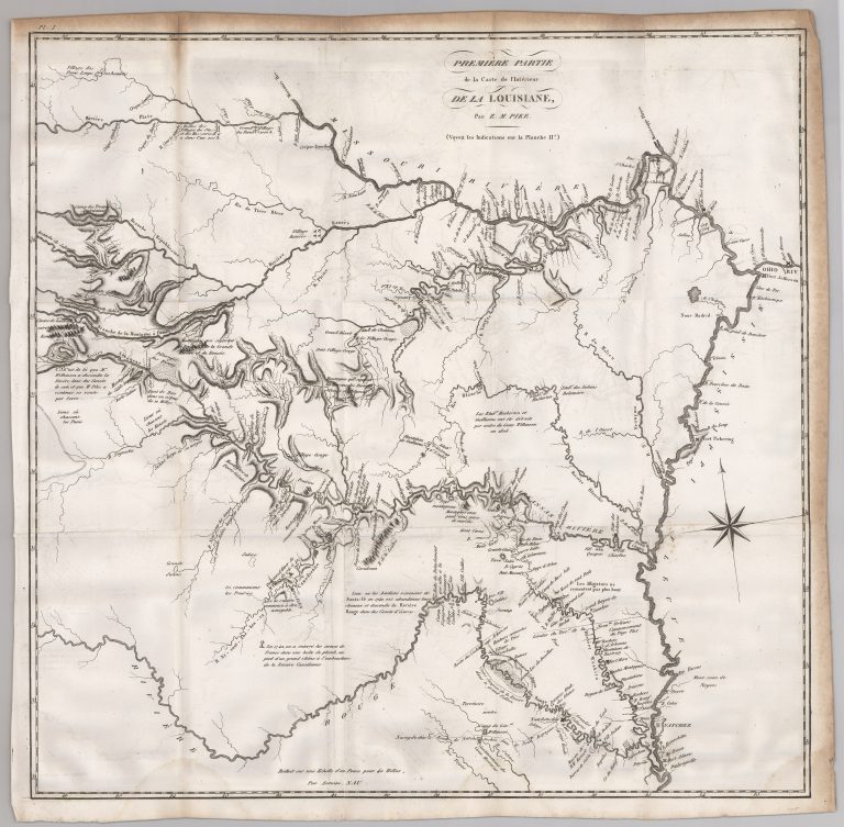
1812: Premiere Partie de la Carte de l’Interieur de la Louisiane
Cartography:
Zebulon Pike
Zebulon Pike
This map is from the French edition of Zebulon Pike’s 1810 report entitled An Account of Expeditions to the Sources … See more Premiere Partie de la Carte de l’Interieur de la Louisiane
20
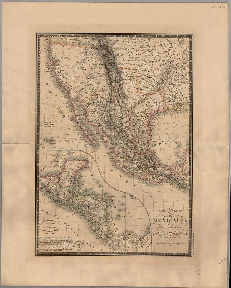
1825: Carte Generale des Etats-Unis Mexicains et des Provinces-Unies de l’Amerique Centrale
Cartography:
Adrien Brue
Adrien Brue
This is the first major map of Mexico following its independence from Spain on 24 August 1821. It was published … See more Carte Generale des Etats-Unis Mexicains et des Provinces-Unies de l’Amerique Centrale