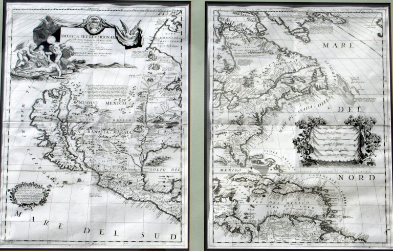
This was one of the most influential maps of North America published in the late 17th Century. Coronelli was a … See more America Settentrionale
Geography: America (58 Maps)
Show Maps with Images Only12
1703/1708: Carte du Mexique et de la Floride
Cartography:
Guillaume Del'Isle
Guillaume Del'Isle
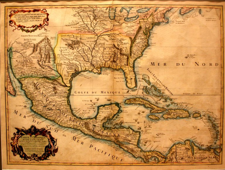
This map, by French cartographer Guillaume Del’Isle (1675-1726), shows both the Mississippi River and the Rio Grande, thus making it … See more Carte du Mexique et de la Floride
13
1705: Carte de Californie et du Nouveau Mexique
Cartography:
Nicolas de Fer
Nicolas de Fer
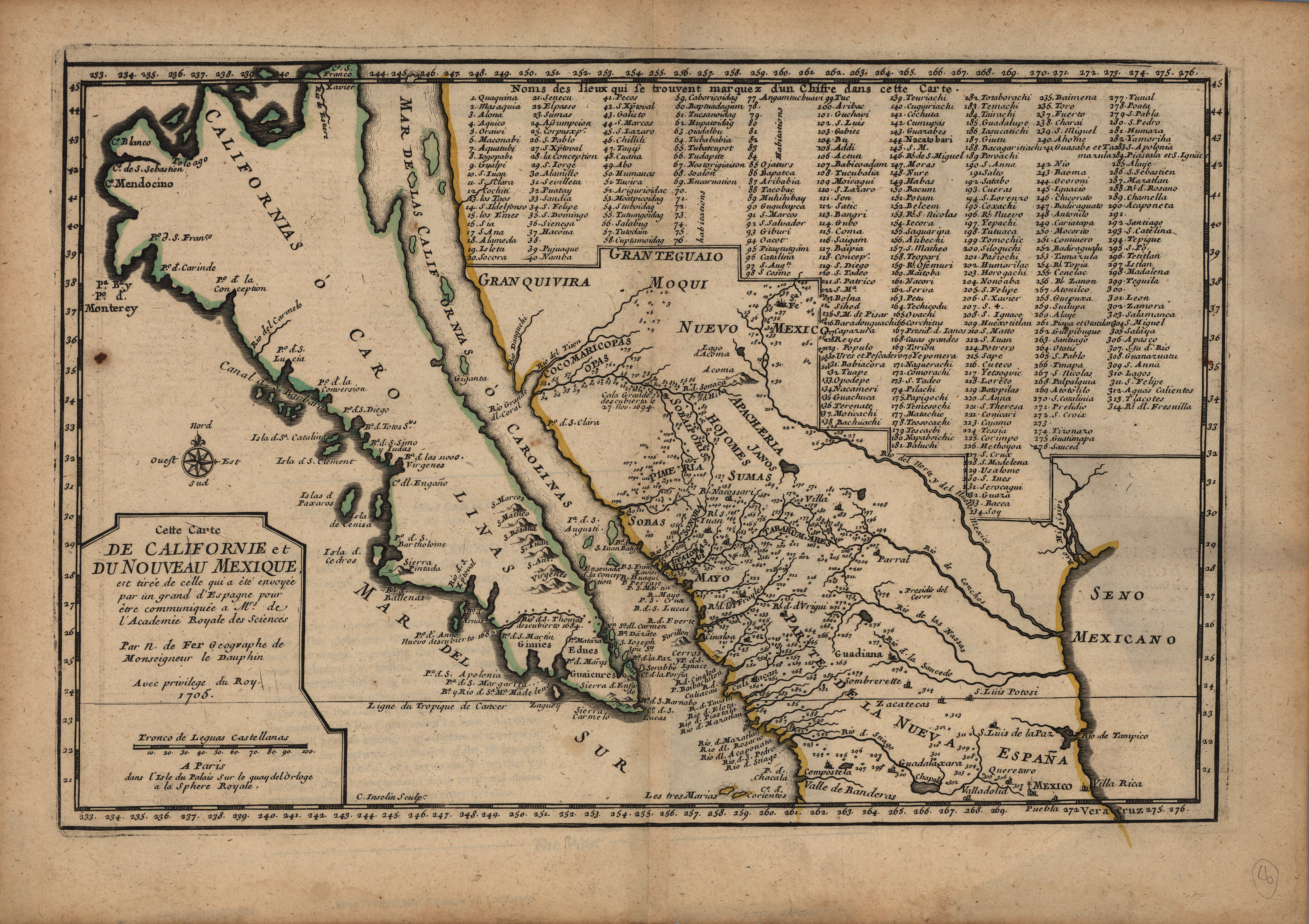
Copper engraved in Paris in 1705 and published in De Fer’s L’Atlas Curieux, this map is based on the explorations … See more Carte de Californie et du Nouveau Mexique
14
1705: Nouvelle Carte de L’Amerique Septentrionale
Cartography:
Henri Chatelain
Henri Chatelain
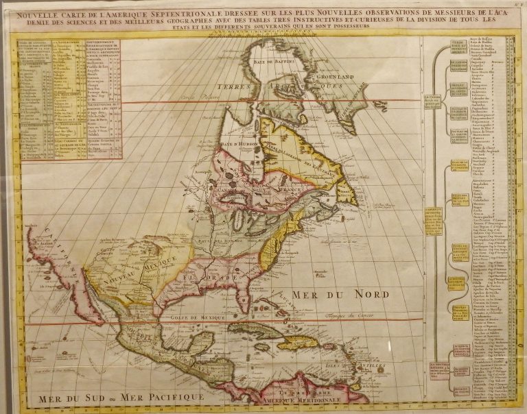
Published by Chatelain in Amsterdam in the 1705 edition of his Atlas Historique. Shows some of the first correct depictions … See more Nouvelle Carte de L’Amerique Septentrionale
15
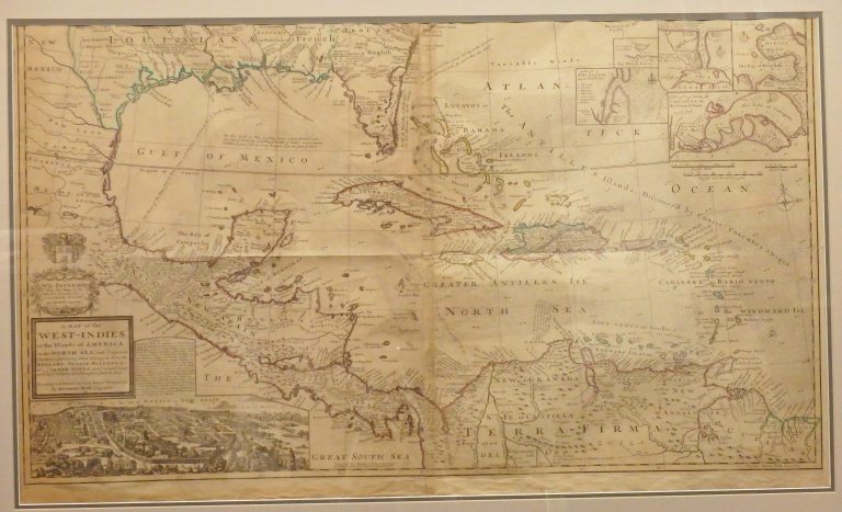
1715: A Map of the West Indies or the Islands of America in the North Sea, with ye adjacent Countries
Cartography:
Herman Moll
Herman Moll
One of the most remarkable maps of the West Indies to appear in the 18th Century. In addition to showing … See more A Map of the West Indies or the Islands of America in the North Sea, with ye adjacent Countries
16
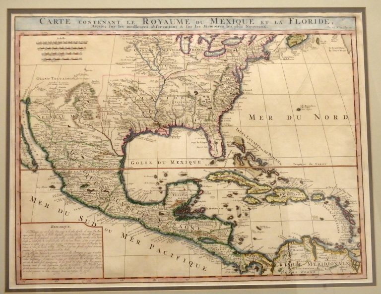
1719: Carte Contenant Le Royaume Du Mexique Et La Floride
Cartography:
Henri Chatelain
Henri Chatelain
This 1719 map by Dutch cartographer Henri Chatelain, covering the southern portion of North America, was basically an updated map … See more Carte Contenant Le Royaume Du Mexique Et La Floride
17
1723: A General Description of America
Cartography:
Herman Moll
Herman Moll
English cartographer Herman Moll’s maps were not only important during his lifetime, even helping settle many of the imperial disputes … See more A General Description of America
18
1725: Mississippi Seu Provinciae Ludovicianae
Cartography:
Johann Baptista Homann
Johann Baptista Homann
Striking example of Homann’s map of the Course of the Mississipp River, based upon the reports of Hennepin, who explored … See more Mississippi Seu Provinciae Ludovicianae
19
1735: A Map of New France Containing Canada, Louisiana, in North America
Cartography:
Herman Moll
Herman Moll
Moll’s map of New France. The map provides an especially detailed look at the regions between the Appalachians and the … See more A Map of New France Containing Canada, Louisiana, in North America