Printed in his “Metallick History of the Reigns of King William, Mary, Anne and George I,” this is one of … See more A map of North America
Geography: America (58 Maps)
Show Maps with Images Only22
1750: Carta Geographica della Florida Nell’ America Settentrionale
This map by the notable Venetian collector and publisher Giambattista Albrizzi depicts the French claims to Florida prior to the … See more Carta Geographica della Florida Nell’ America Settentrionale
23
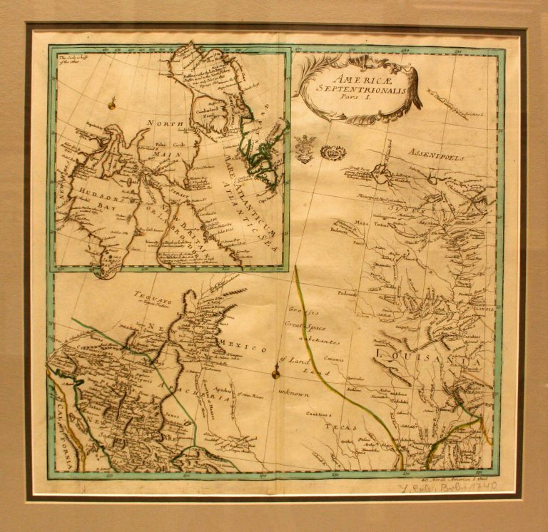
1753: Americae Septentrionalis, Pars 1
Cartography:
Leonhard Von Euler
Leonhard Von Euler
This 1753 map, by Swiss mathematician Leonhard Von Euler, is the first map to show Texas (Tecas) as a region, … See more Americae Septentrionalis, Pars 1
24
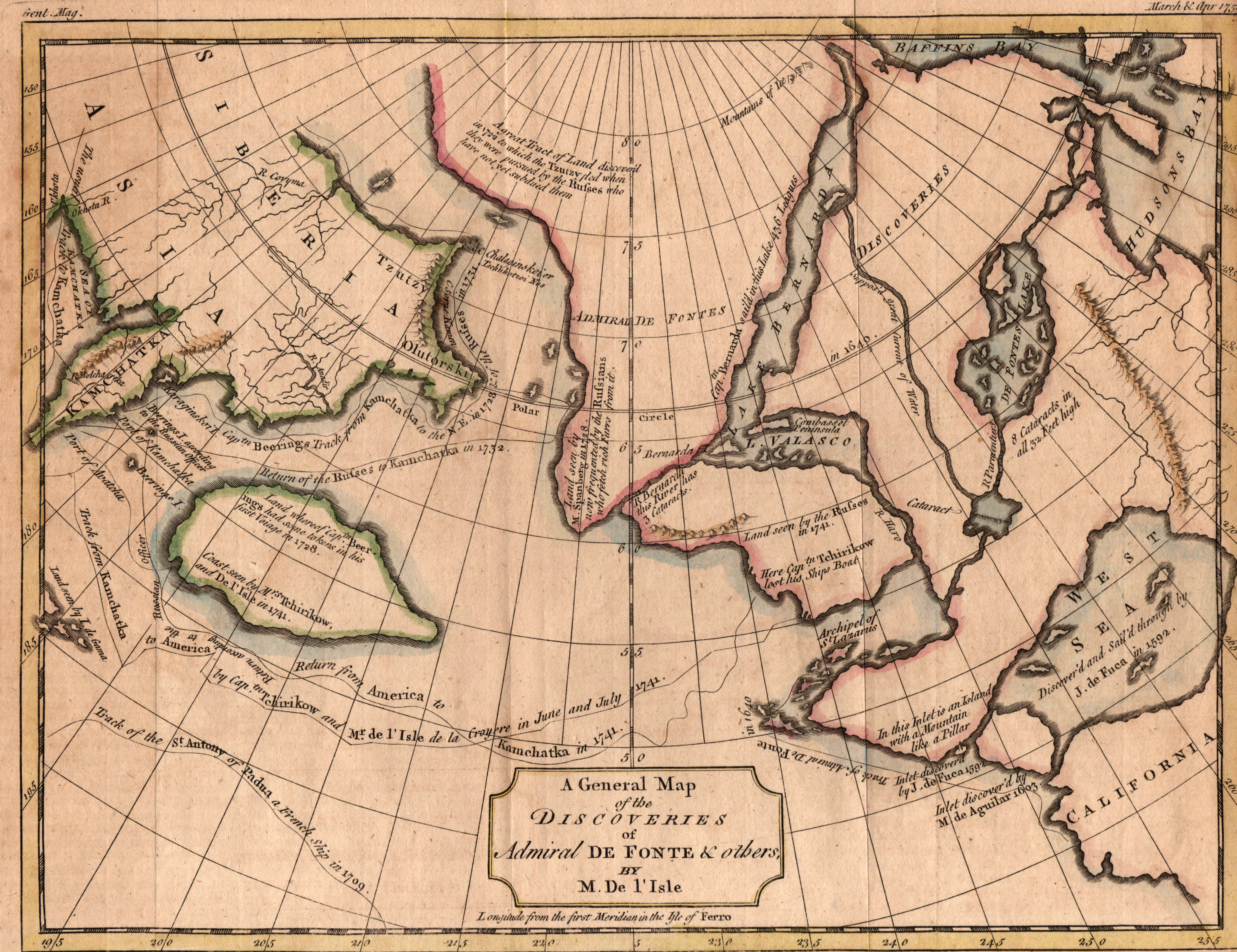
1757: A General Map of the Discoveries of Admiral De Fonte & others by M. Del’Isle
Cartography:
Thomas Kitchin
Thomas Kitchin
This map by Thomas Kitchin is his version of the 1752 map published in Paris by M. Del’Isle, depicting the … See more A General Map of the Discoveries of Admiral De Fonte & others by M. Del’Isle
26
1775: A New and Correct Map of North America, with the West India Islands Divided According to the Last Treaty of Peace, Concluded at Paris 19 February 1763
Cartography:
John Gibson
John Gibson
Contains an inset of Father Eusebio Kino’s map of the American Southwest and Baja California, entitled “The Passage of Land … See more A New and Correct Map of North America, with the West India Islands Divided According to the Last Treaty of Peace, Concluded at Paris 19 February 1763
27
1780: Etats Unis De L’Amerique
Cartography:
Bonne Rigobert
Bonne Rigobert
Eastern section of a pair of maps covering the territory of the new United States. This section covers the eastern … See more Etats Unis De L’Amerique
28
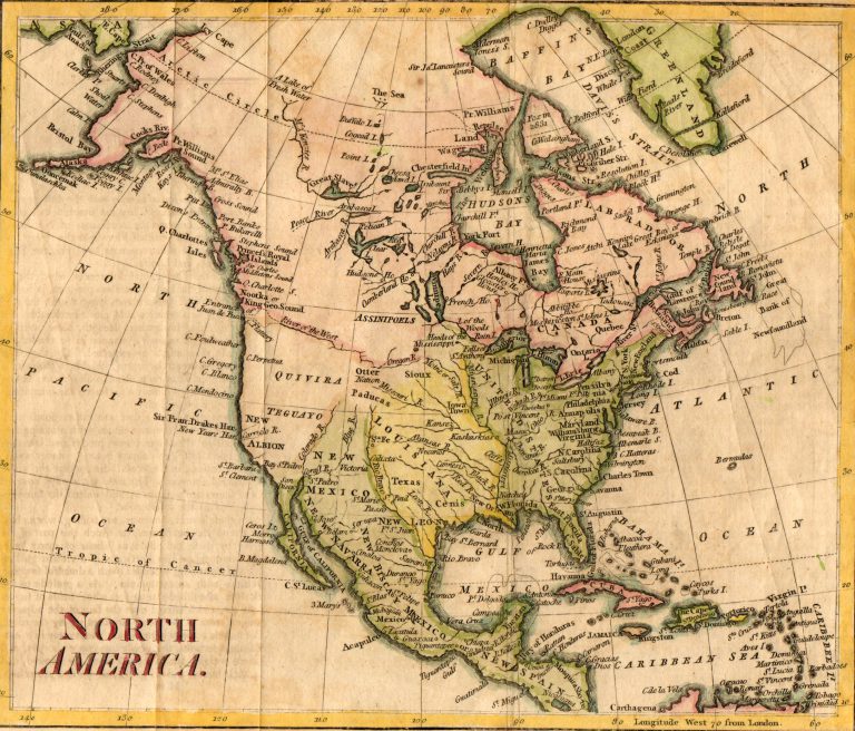
1785: North America
Cartography:
Thomas Kitchin
Thomas Kitchin
This is the first map to use the current spelling of TEXAS. Note that it shows Texas as part of … See more North America
30
1803: Amerique Septentrionale
Cartography:
Jean Baptiste Poirson
Jean Baptiste Poirson
Fascinating early map of North America, issued immediately after the Louisiana Purchase in early 1803. The most immediately noticable feature … See more Amerique Septentrionale