German version of Carey and Lea’s 1823 Map of Mexico. Printed in Saxony.
Geography: Mexico (39 Maps)
Show Maps with Images Only22
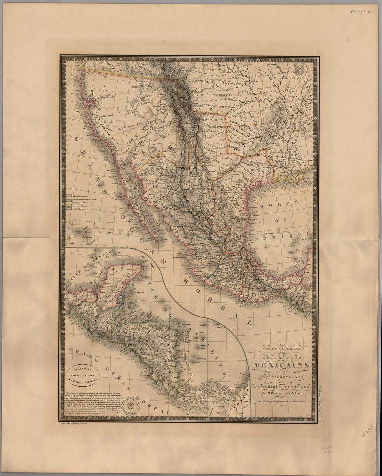
1825: Carte Generale des Etats-Unis Mexicains et des Provinces-Unies de l’Amerique Centrale
Cartography:
Adrien Brue
Adrien Brue
This is the first major map of Mexico following its independence from Spain on 24 August 1821. It was published … See more Carte Generale des Etats-Unis Mexicains et des Provinces-Unies de l’Amerique Centrale
24
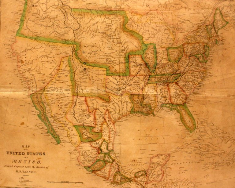
1827: Smiley’s Geography Atlas map of the United States and Mexico
Cartography:
Henry Schenck Tanner
Henry Schenck Tanner
In 1824, Mexico passed a new constitution which combined the two states of Texas and Coahuila, and this is the … See more Smiley’s Geography Atlas map of the United States and Mexico
25
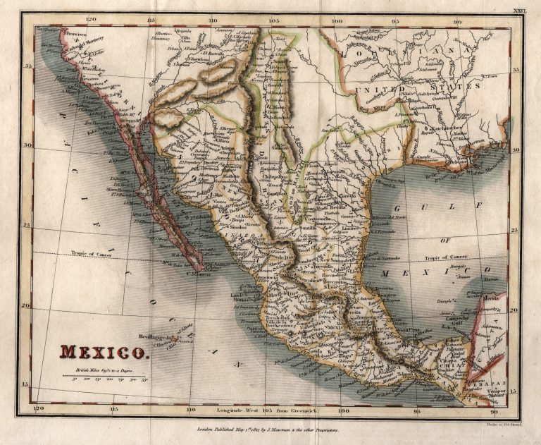
1827: Mexico
Cartography:
Neely & Sons
Neely & Sons
Map of Mexico, printed in England in 1827. The region of Texas between the Red River and the Pecos (Puerco) … See more Mexico
26
1827: Geographical, Statistical and Historical Map of Mexico
Cartography:
I. Lea
I. Lea
Shows the Province of Texas as part of the Intendencia of San Luis Potosi, and Presidio de Bejar as the … See more Geographical, Statistical and Historical Map of Mexico