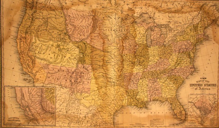
This is the first map to show Texas following the Compromise of 1850. From early on in American history, the … See more A New Map of the United States
Theme: Political (56 Maps)
Show Maps with Images Only52
1853: Texas
Cartography:
Joseph Hutchins Colton
Joseph Hutchins Colton
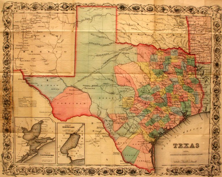
This is the first pocket map of Texas following the Compromise of 1850. Designed to be folded up into its … See more Texas
53
1857: Map of the United States and their Territories Between the Mississippi and the Pacific Ocean, and Part of Mexico
Cartography:
William H. Emory
William H. Emory
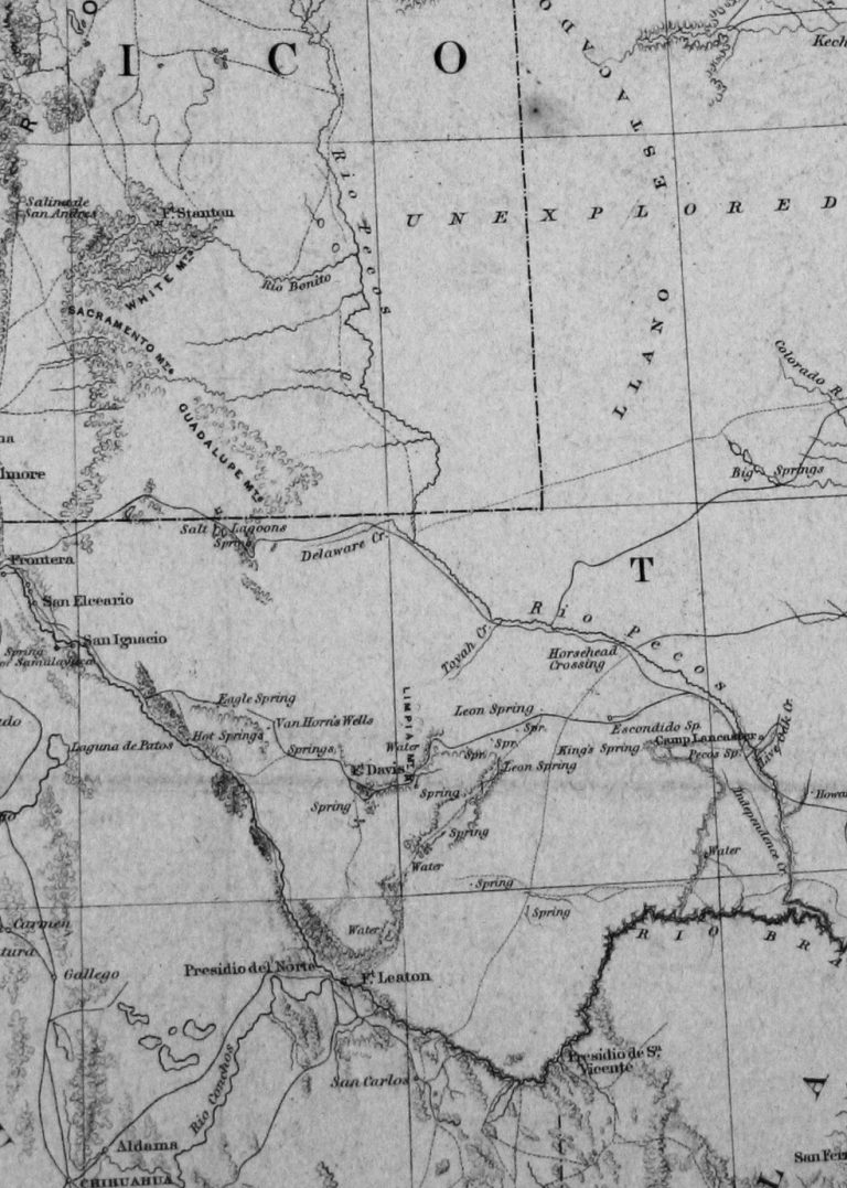
Article V of the Treaty of Guadalupe-Hidalgo, which ended the U.S.-Mexico War, specified in part that In order to designate … See more Map of the United States and their Territories Between the Mississippi and the Pacific Ocean, and Part of Mexico
54
1905: State of Sequoyah
Cartography:
D. W. Bolich
D. W. Bolich
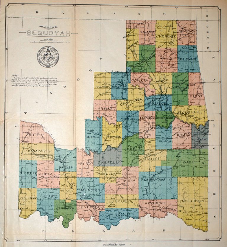
Map of the proposed STATE OF SEQUOYAH, published by the August Gast Bank and Note Company. Following the breakup of … See more State of Sequoyah
55
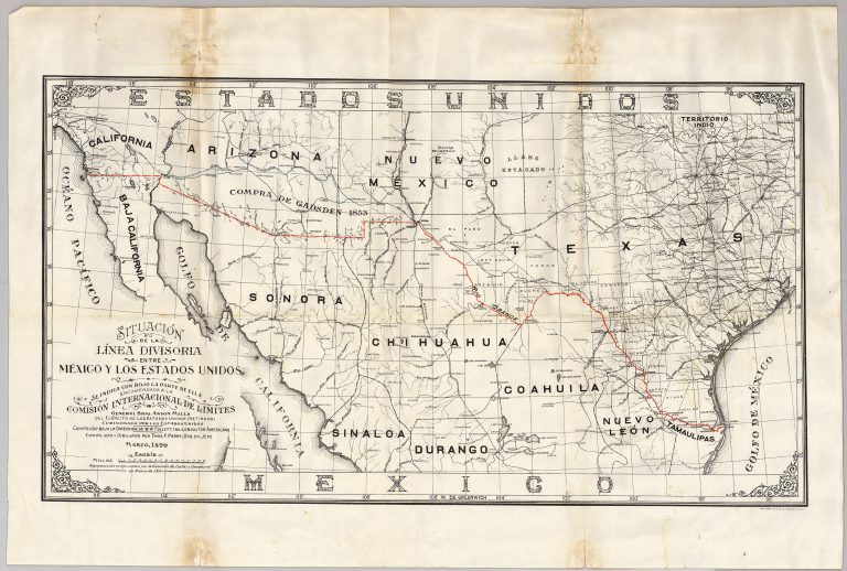
1911: Situacion de la Linea Divisoria entre Mexico y Los Estados Unidos
Cartography:
Thomas E. Perry
Thomas E. Perry
Anson Mills, after failing out at West Point in 1857, settled in El Paso, Texas, where be was hired by … See more Situacion de la Linea Divisoria entre Mexico y Los Estados Unidos