Printed in Weimar, Germany
Theme: Political (56 Maps)
Show Maps with Images Only42
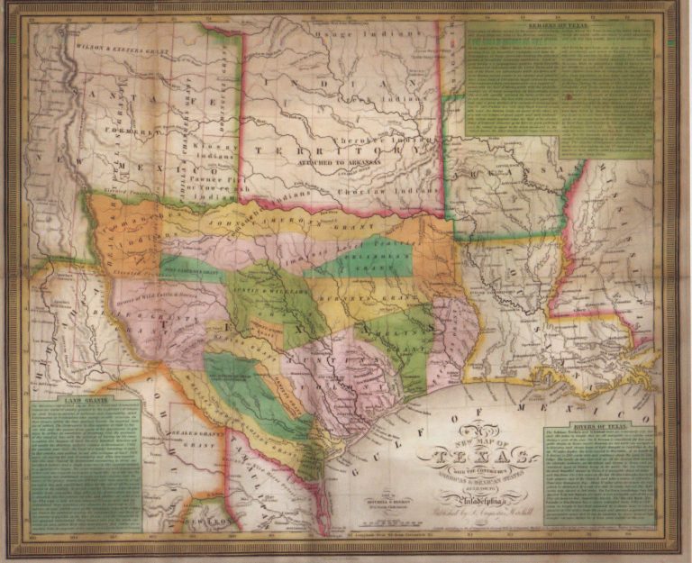
1835: A New Map of Texas
Cartography:
J. H. Young
J. H. Young
One of the most influential of the Republic of Texas maps, just predating the revolution by months. This map was … See more A New Map of Texas
43
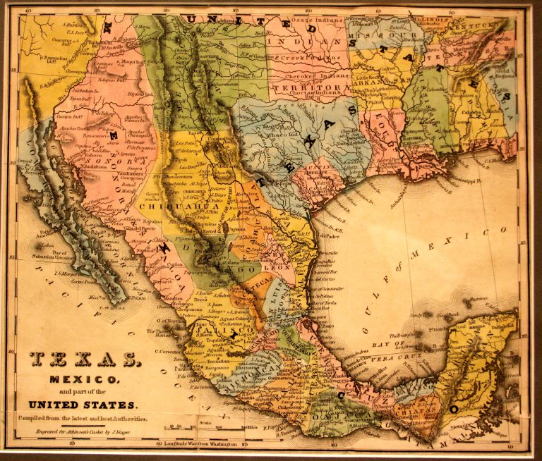
1836: Texas, Mexico and Part of the United States
Cartography:
Joseph Yeager
Joseph Yeager
On the 2nd of March, 1836, along the banks of Brazos River, as Santa Anna was laying siege to the … See more Texas, Mexico and Part of the United States
44
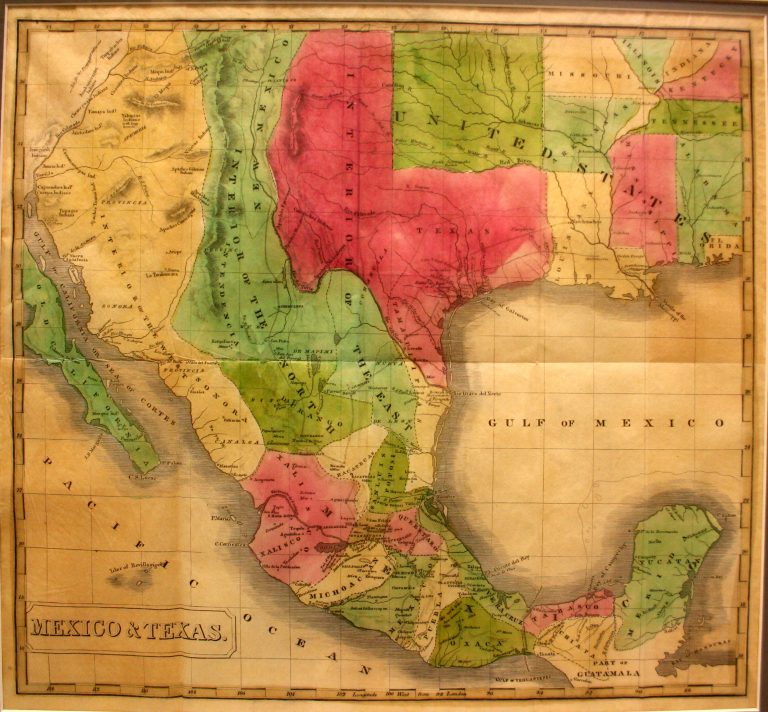
1837: Mexico & Texas
Cartography:
John Milton Niles
John Milton Niles
This 1837 map shows the Republic of Texas extending all the way to the Rio Grande and north to the … See more Mexico & Texas
45
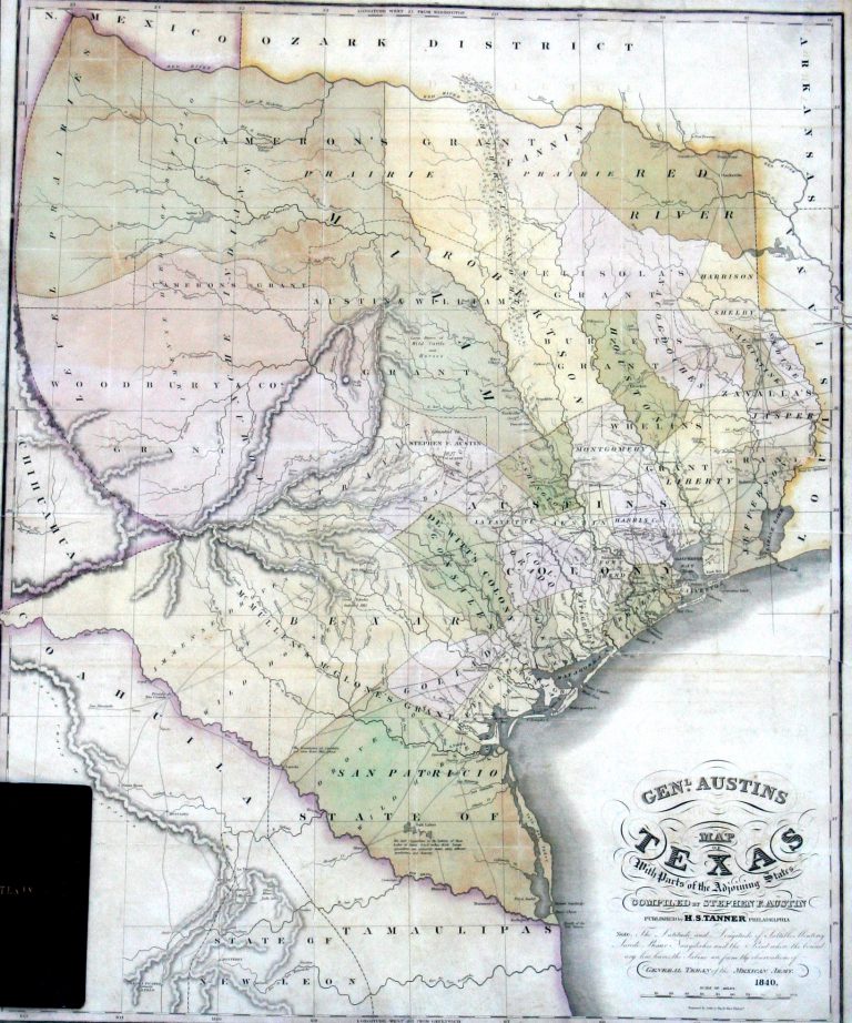
1840: General Austin’s Map of Texas with Parts of Adjoining States
Cartography:
Henry Schenck Tanner
Henry Schenck Tanner
In 1820, Moses Austin secured a land grant in Texas from the government of New Spain. However, prior to bringing … See more General Austin’s Map of Texas with Parts of Adjoining States
46
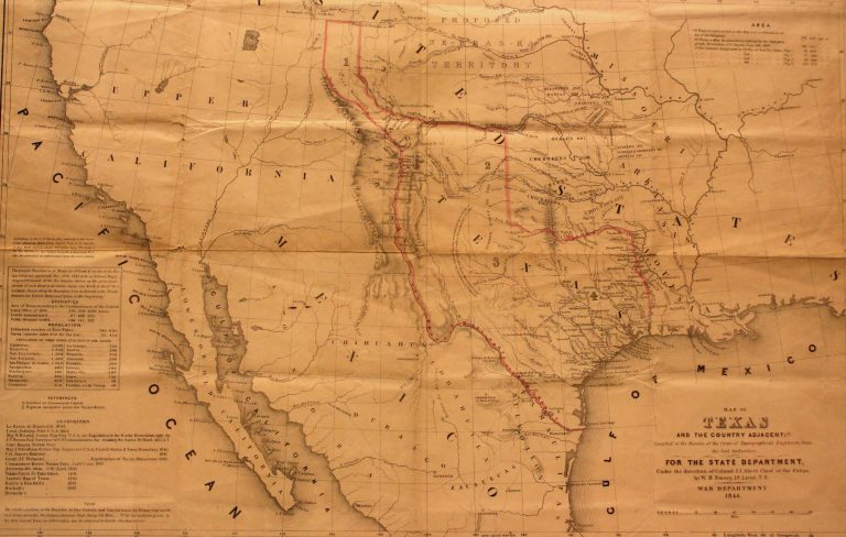
1844: Map of Texas and Countries Adjacent
Cartography:
William H. Emory
William H. Emory
In 1844, James K. Polk was elected to the office of the Presidency on the platform of “Manifest Destiny,” which … See more Map of Texas and Countries Adjacent
47

1845: The United States, The Relative Position of The Oregon & Texas and California
Cartography:
James Wyld
James Wyld
An interesting map, most likely printed in 1845, showing the United States just before the annexation of Texas and the … See more The United States, The Relative Position of The Oregon & Texas and California
48
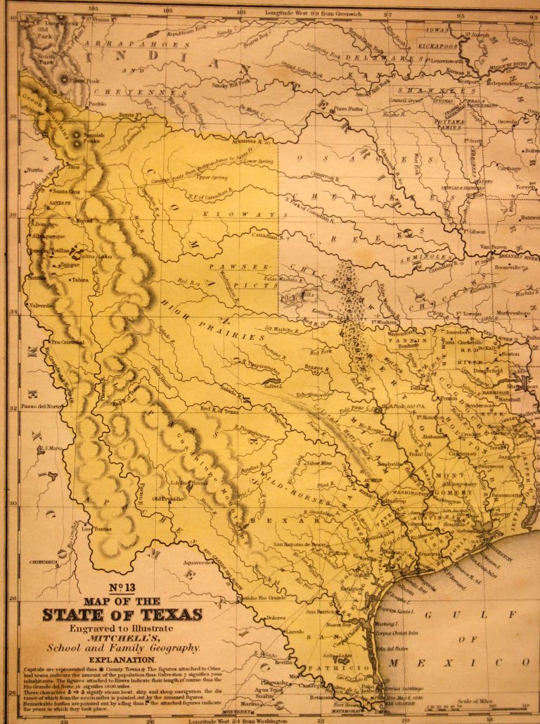
1846: Map of the State of Texas, No. 13
Cartography:
Samuel Augustus Mitchell
Samuel Augustus Mitchell
On 29 December 1845, the U.S. Congress admitted Texas as the 28th state of the United States, and this 1846 … See more Map of the State of Texas, No. 13
49
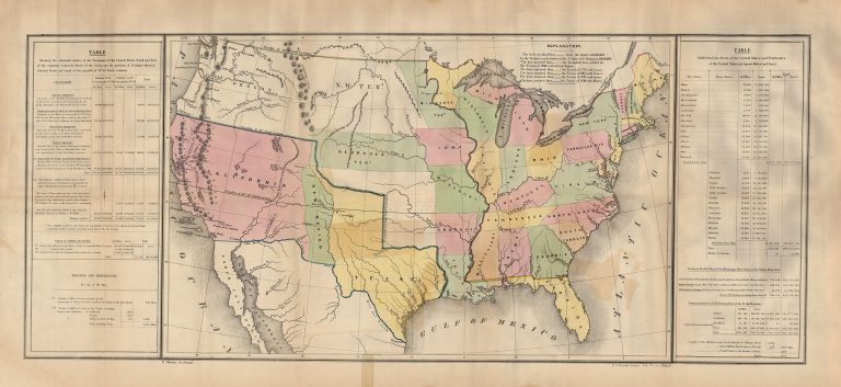
1848: Lines of Treaty Map of the United States between 1783 and 1848
Cartography:
U.S. Government
U.S. Government
This map shows the United States following the US-Mexico War (1846-48), but prior to the Compromise of 1850 and the … See more Lines of Treaty Map of the United States between 1783 and 1848
50
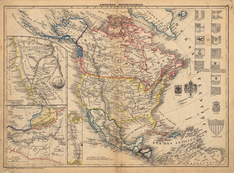
1849: Amerique Septentrionale
Cartography:
Philippe Vandermaelen
Philippe Vandermaelen
This 1849 map perhaps the first map made using the lithographic process to show the Republic of Texas. Printed by Philippe Vandermaelen … See more Amerique Septentrionale