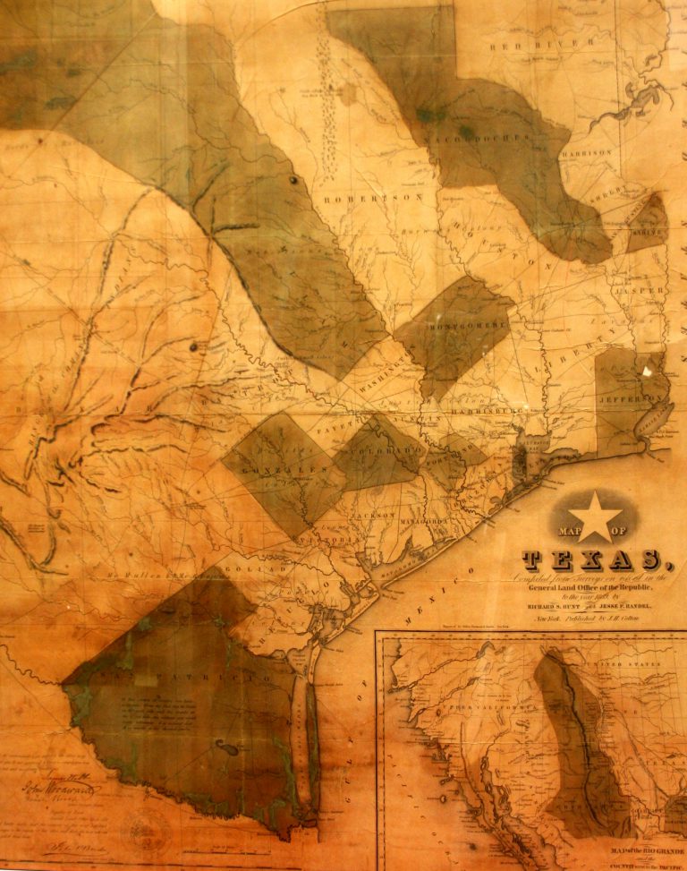
This map was published in 1839 by Richard A. Hunt and Jesse F. Randel in the first travel guide to … See more Map of Texas
Theme: Transportation (4 Maps with Images)
Show All Maps2
1847: Mitchell’s New Travelers Guide Through the United States
Cartography:
Charles Desilver
Charles Desilver
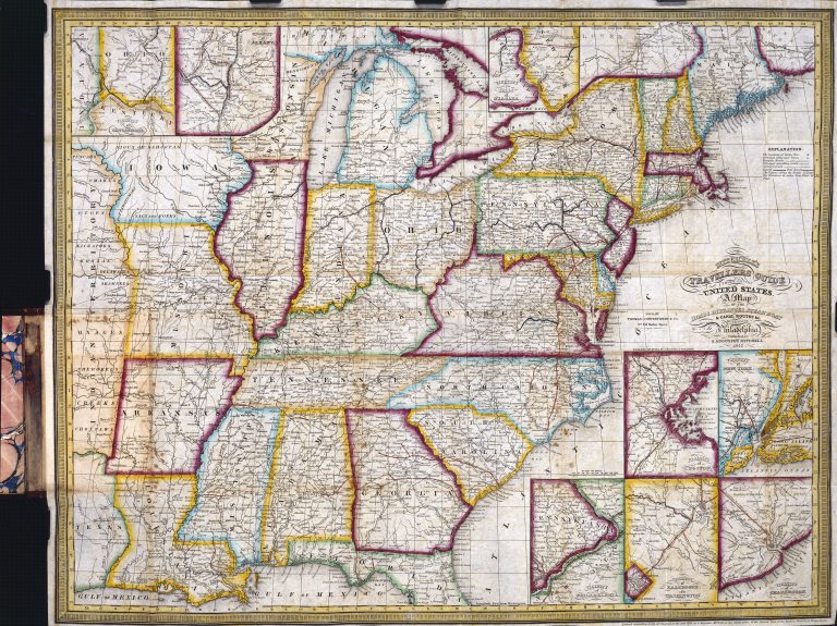
Depicting the eastern half of the United States, from Texas to the Atlantic seaboard, this 1847 map was made with … See more Mitchell’s New Travelers Guide Through the United States
3
1849: Reconnaissances of Routes From San Antonio de Bexar to El Paso del Norte
Cartography:
Joseph E. Johnston
Joseph E. Johnston
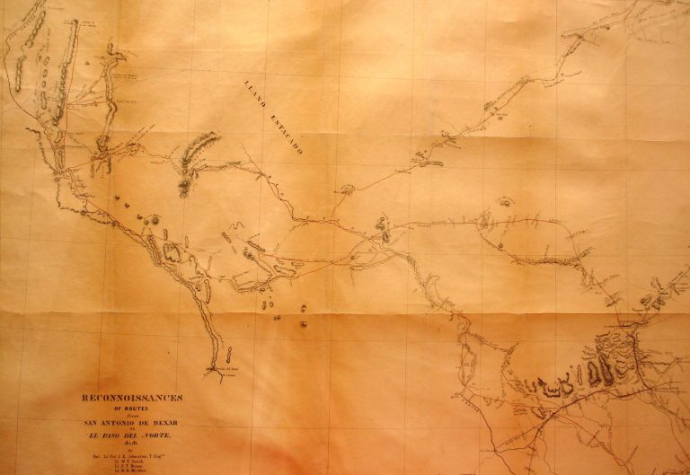
While the Treaty of Guadalupe-Hidalgo was being negotiated in February of 1948, formally bringing an end to the U.S.-Mexico War, … See more Reconnaissances of Routes From San Antonio de Bexar to El Paso del Norte
4
1928: State Highway System of Texas
Cartography:
Dallas Morning News
Dallas Morning News
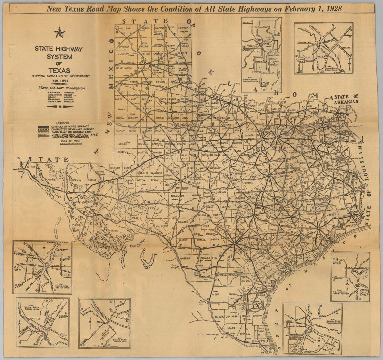
No coordinated transportation system existed in Texas until the advent of the automobile at the beginning of the 20th century. … See more State Highway System of Texas