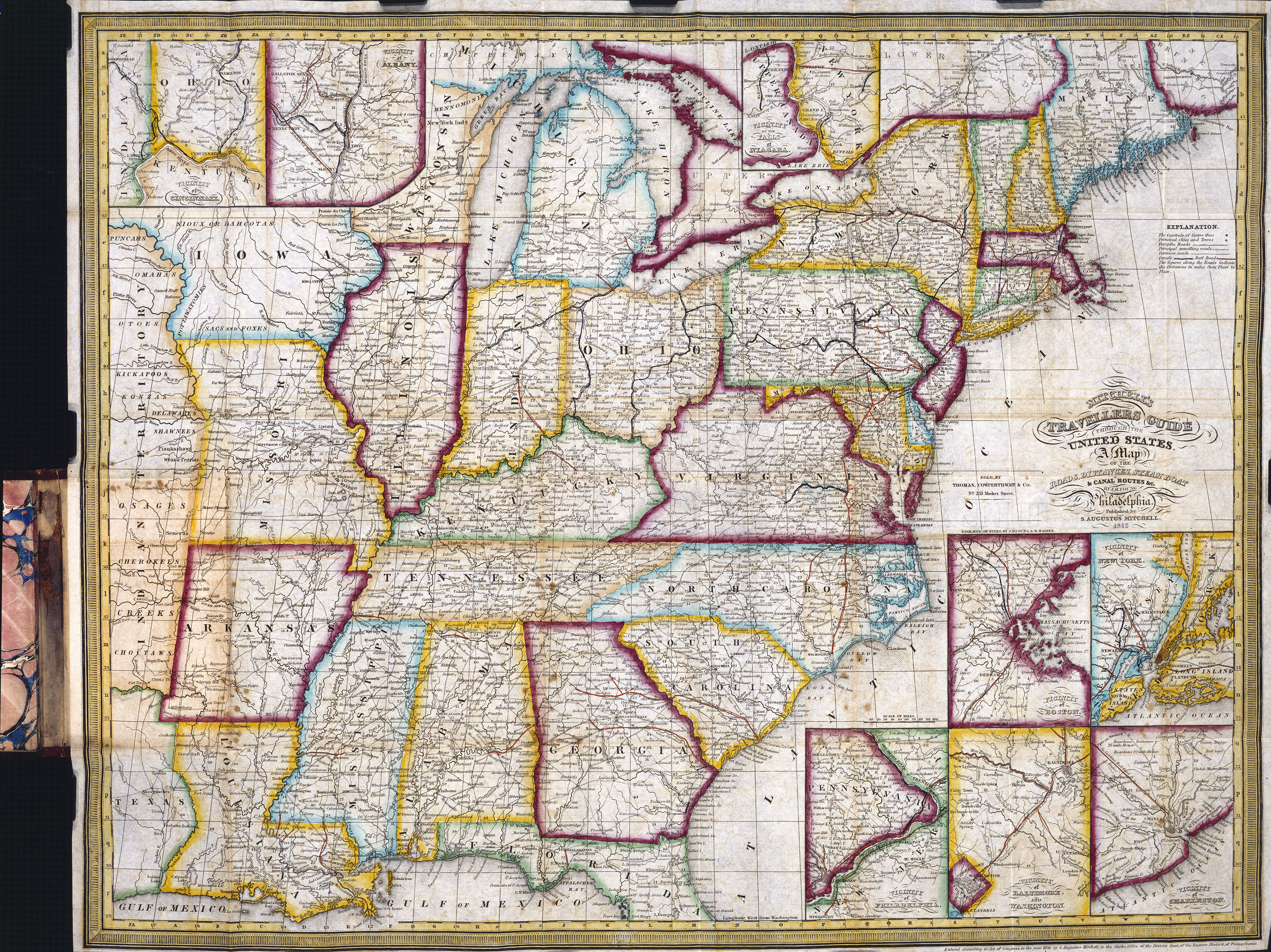
Depicting the eastern half of the United States, from Texas to the Atlantic seaboard, this 1847 map was made with the traveler in mind, and includes roads (in black), railroads (in red) and canals (in blue). During the “Manifest Destiny” period, when the United States was expanding westward, this map was printed as a folding pocket map and was one of the most popular of the day. The inset maps included maps of Cincinnati and vicinity, Albany and vicinity, Niagara Falls and vicinity, New York City and vicinity, Boston and vicinity, Charleston and vicinity, Baltimore and Washington, D.C., and vicinity, and Philadelphia and vicinity.
1847 Mitchell’s New Travelers Guide Through the United States
Cartography: Charles Desilver