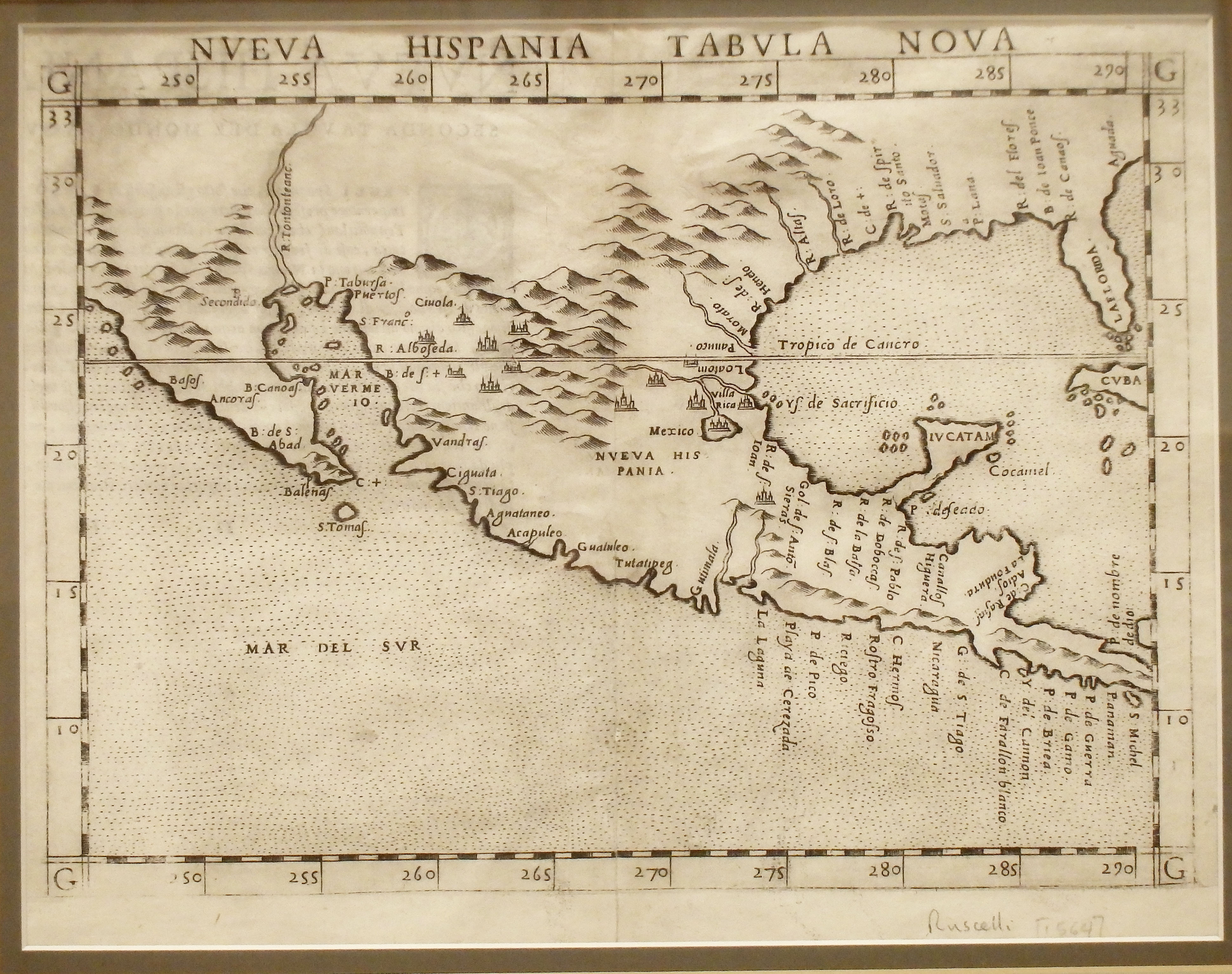
This map is based on updated information provided by explorers Alonso Alvarez de Pineda and Cabeza de Vaca. It correctly shows Yucatan as a peninsula and Baja California as part of the North American continent.
1561 Nueva Hispania Tabula Nova
Cartography: Giralomo Ruscelli