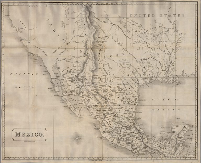
Map of Mexico, published in London as an independent wall map and not part of an atlas, indicating European interest … See more Mexico
Geography: Mexico (5 Maps with Images)
Show All Maps32
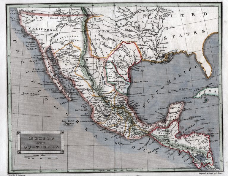
1829: Mexico and Guatimala
Cartography:
Thomas Tegg
Thomas Tegg
This 1829 map, by London-based printer Thomas Tegg, shows a diamond-shaped Texas as its own state in Mexico, but as … See more Mexico and Guatimala
33
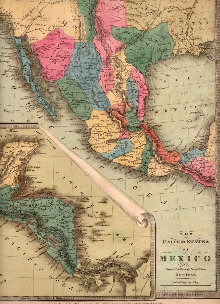
1832/1835: The United States of Mexico
An interesting map by American cartographer David Burr, showing the Mexican state of TEXAS, with its border with Coahuila located … See more The United States of Mexico
34
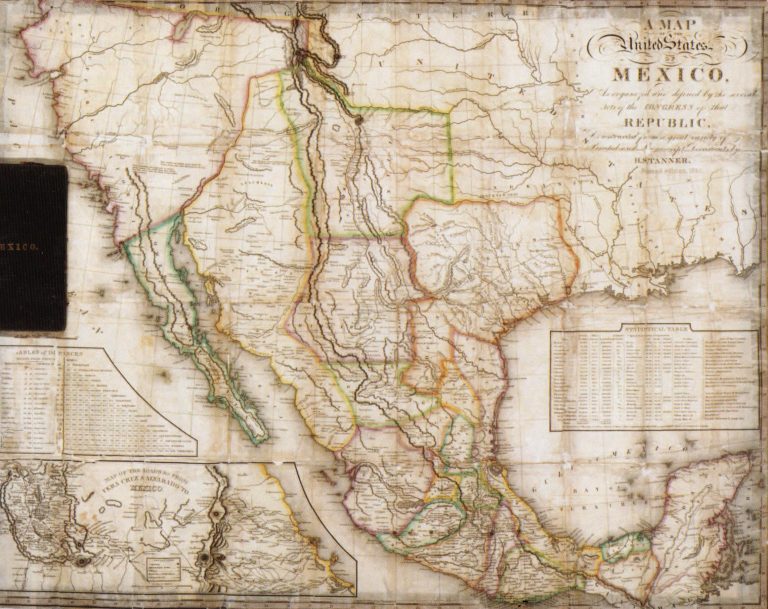
1834: Map of the United States of Mexico as Organized and Defined by the Congress of that Republic
Cartography:
Henry Schenck Tanner
Henry Schenck Tanner
This large pocket map includes two insets, a) Table of Distances and b) Map of the Roads from Vera Cruz … See more Map of the United States of Mexico as Organized and Defined by the Congress of that Republic
35
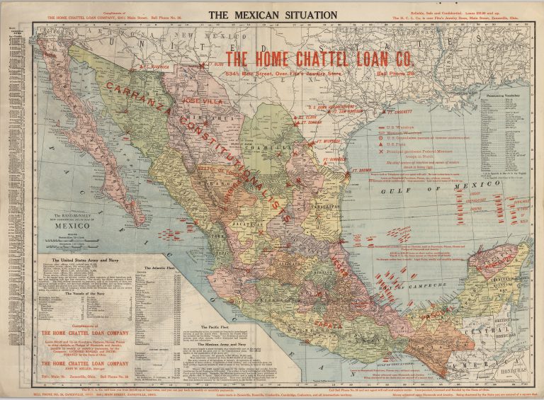
1914: The Mexican Situation
Cartography:
McNally & Company
McNally & Company
The Mexican Situation map was created by the Home Chattel Loan Company of Chicago, Illinois, by simply overprinting a standard … See more The Mexican Situation