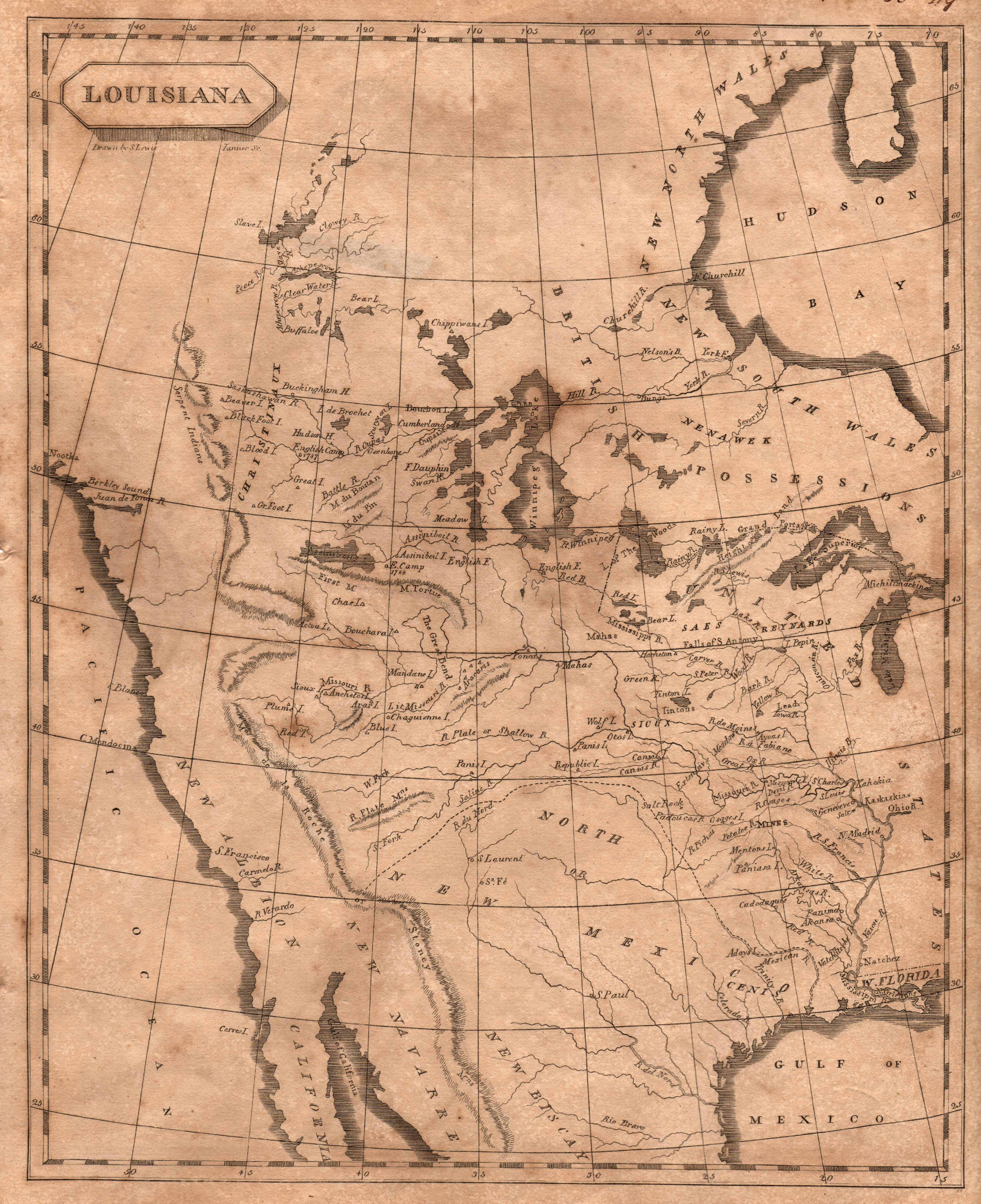
The classic map of 1804 produced by British cartographer Aaron Arrowsmith and American cartographer, Samuel Lewis (later cartographer for Lewis … See more Louisiana
Geography: America (58 Maps)
Show Maps with Images Only32
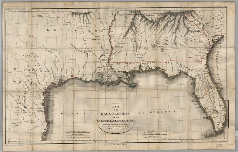
1807: Carte des Deux Florides et de La Louisiane Inferieure
Cartography:
Jean Baptiste Poirson
Jean Baptiste Poirson
The Texas provincial cities of St. Antoine de Bexar and Nacogcoches are located on this map. The Gulf Coast, according … See more Carte des Deux Florides et de La Louisiane Inferieure
34
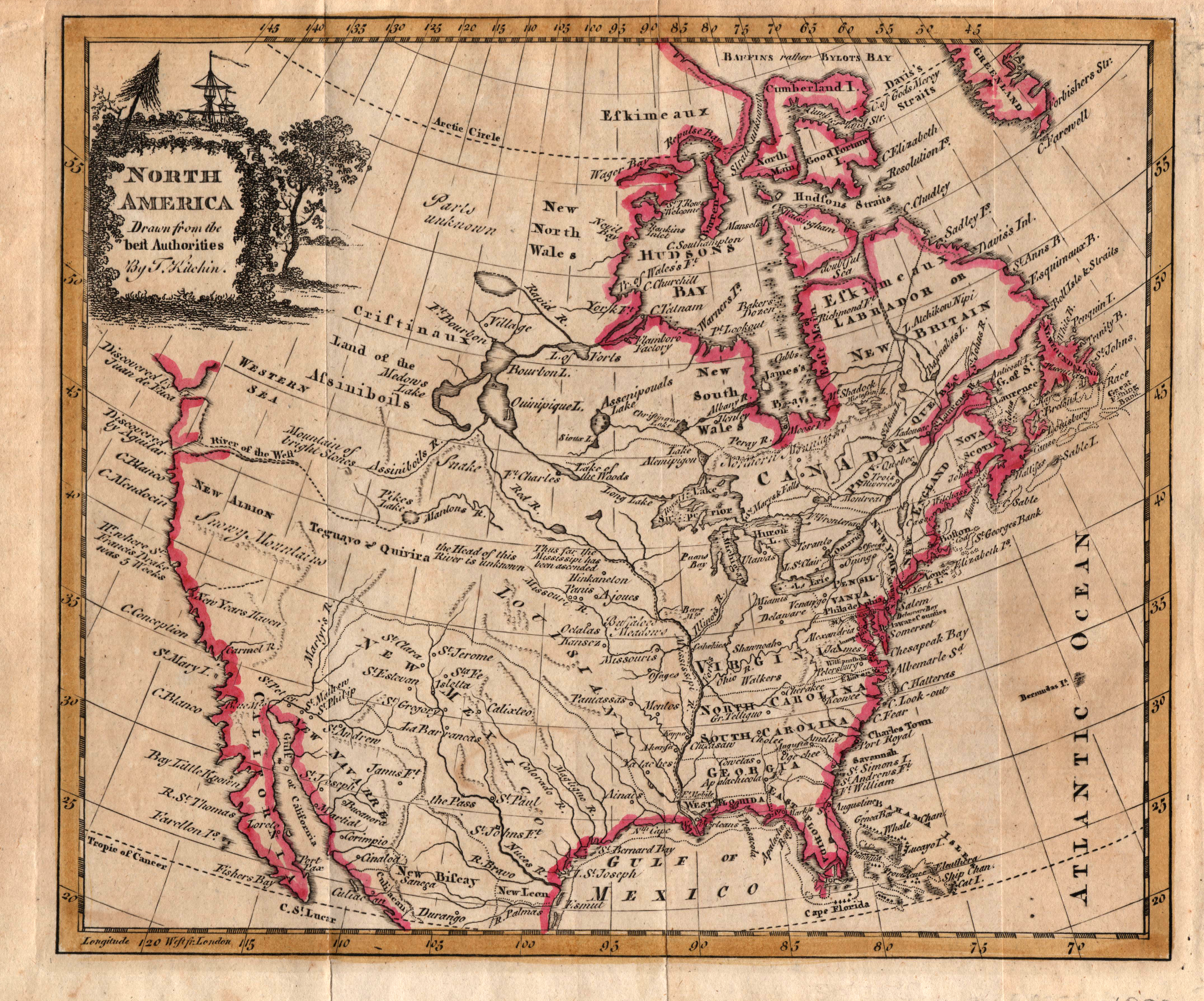
1808: North America, drawn from the Best Authorities
Cartography:
Thomas Kitchin
Thomas Kitchin
An early map of North America with the new states of the United States and the British provinces and colonies … See more North America, drawn from the Best Authorities
35
1811: A Map of New Spain from 16 to 38 degrees North Latitude
Cartography:
Alexander von Humboldt
Alexander von Humboldt
Reduced from a large map drawn from astronomical observations at Mexico in the year 1804. Shows Texas as part of … See more A Map of New Spain from 16 to 38 degrees North Latitude
36
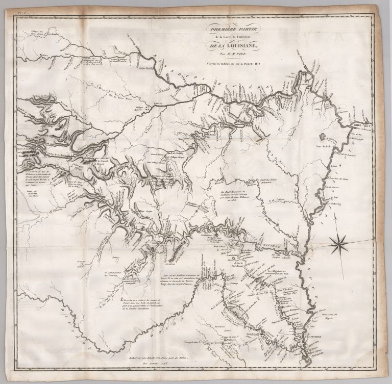
1812: Premiere Partie de la Carte de l’Interieur de la Louisiane
Cartography:
Zebulon Pike
Zebulon Pike
This map is from the French edition of Zebulon Pike’s 1810 report entitled An Account of Expeditions to the Sources … See more Premiere Partie de la Carte de l’Interieur de la Louisiane
39
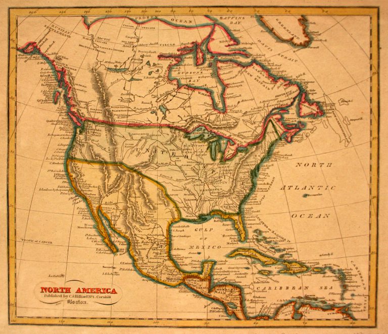
1816: North America
Cartography:
Jacob Abbot Cummings
Jacob Abbot Cummings
In 1803, Emperor Napoleon Bonaparte sold Louisiana to the United States. The southwestern boundary of Louisiana was unclear, however; where … See more North America
40
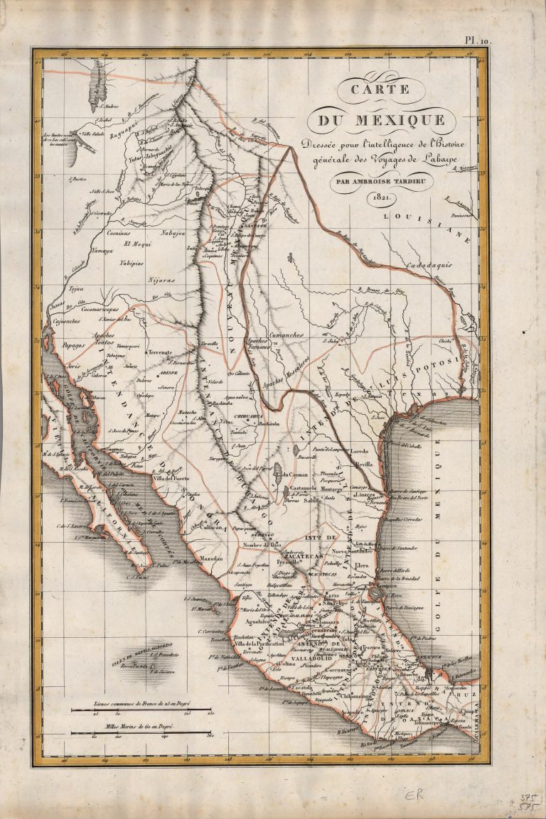
1821: Carte du Mexique
Cartography:
Ambroise Tardieu
Ambroise Tardieu
Fine Humboldt-inspired map of Mexico, in the midst of its struggle for Independence from Spain, published the same year as … See more Carte du Mexique