
This interesting map was engraved by B. Tardieu, a member of the famous Tardieu family of French engravers, and was … See more Amerique Septentrionale
Geography: America (58 Maps)
Show Maps with Images Only42
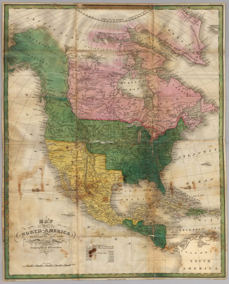
1826: Map of North America
Cartography:
Anthony Finley
Anthony Finley
Anthony Finley’s 1826 large-format map of North America. Russian Possessions (Alaska) and a large 54-40 or fight border with the … See more Map of North America
43
1826: Geographical, Historical and Statistical Map of America
Cartography:
Jehospaphat Aspin
Jehospaphat Aspin
Shows “The Tracks of Columbus and Cortez” and “South America with the Conquests of Pizarro” for the “Eludidation of L. … See more Geographical, Historical and Statistical Map of America
45
1827: Tableau Provisoire D’Assembloge.. L’Amerique…
Cartography:
Philippe Vandermaelen
Philippe Vandermaelen
Rare additional map issued by Vandermaelen, showing how his atlas volumes of North America and South America could be joined … See more Tableau Provisoire D’Assembloge.. L’Amerique…
50
1834: Mexico & Guatemala
Cartography:
Henry Schenck Tanner
Henry Schenck Tanner
Includes insets of “Valley of Mexico” and “Guatemala.” While it has a copyright date of 1834, this map was actually … See more Mexico & Guatemala