The focus of this map is Mexico, Central America, and the Caribbean, though it extends into North America as far … See more Map of the European Settlements in Mexico or New Spain and the West Indies
Geography: Mexico (39 Maps)
Show Maps with Images Only12
1785: Atlante Nouissimo
Cartography:
Antonio Zatta
Antonio Zatta
A decorative and highly detailed map of Mexico, Central America and the southern half of the United States. Excellent detail … See more Atlante Nouissimo
13
1795: Mexico or New Spain in Which the Motions of Cortes May be Traced
Cartography:
Thomas Kitchin
Thomas Kitchin
A map from William Robertson’s popular History of America, one of the first scholarly histories written of the western hemisphere. … See more Mexico or New Spain in Which the Motions of Cortes May be Traced
17
1812: Mexique
Cartography:
J. B. Tardieu
J. B. Tardieu
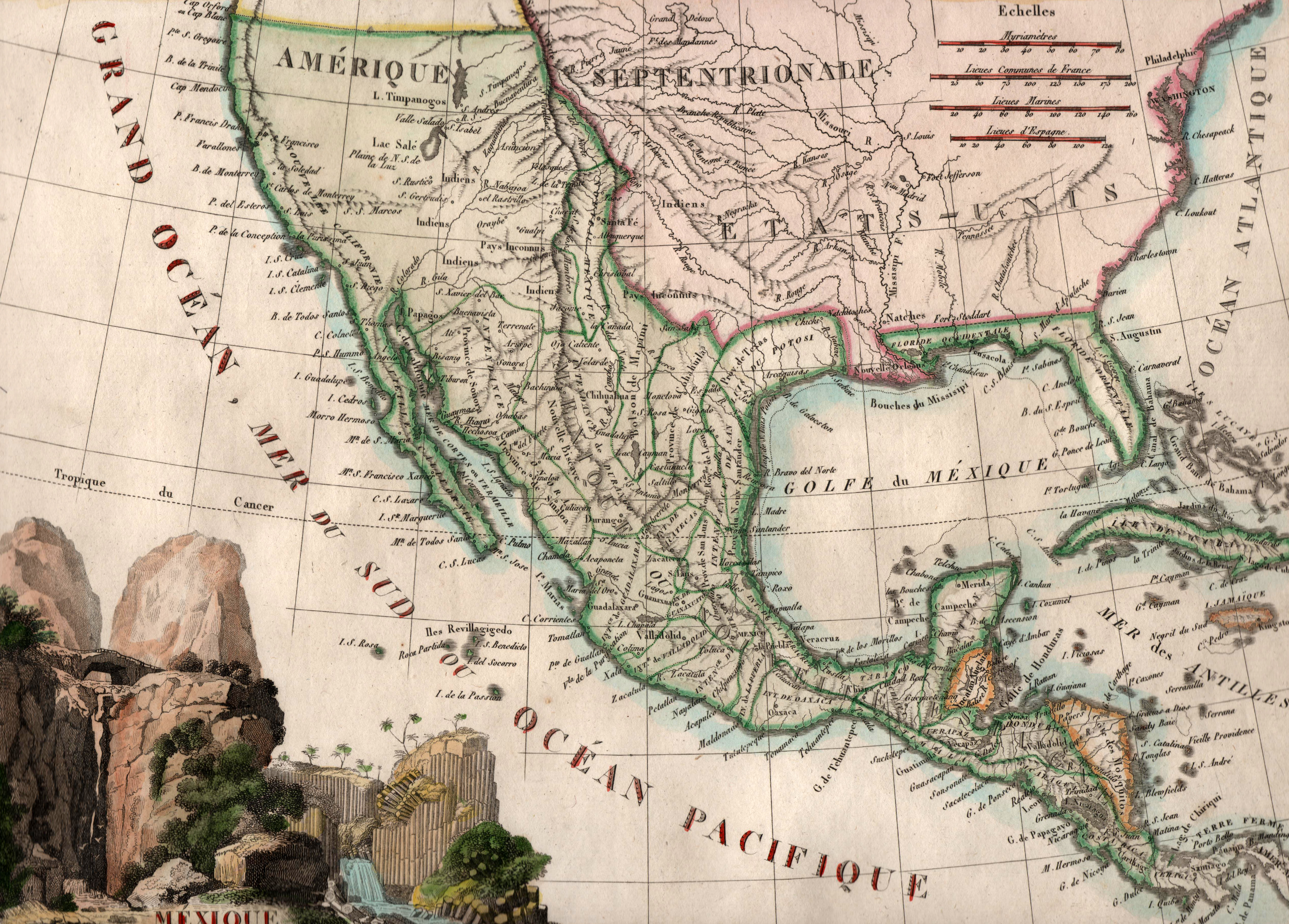
Printed by French cartographer J. B. Tardieu in 1812, just two years after independence was declared from Spain, this map … See more Mexique
18
1817: Mexico
Cartography:
Aaron Arrowsmith
Aaron Arrowsmith
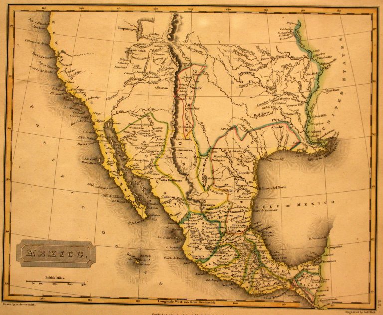
In 1785, the Spanish crown divided New Spain (Mexico) into administrative districts known as “Intendencias.” Texas, which had been part of … See more Mexico
19
1822: United States of America
Cartography:
John Melish
John Melish
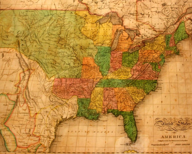
This is the first map in the collection at the Museum of the Big Bend to show Texas as a … See more United States of America