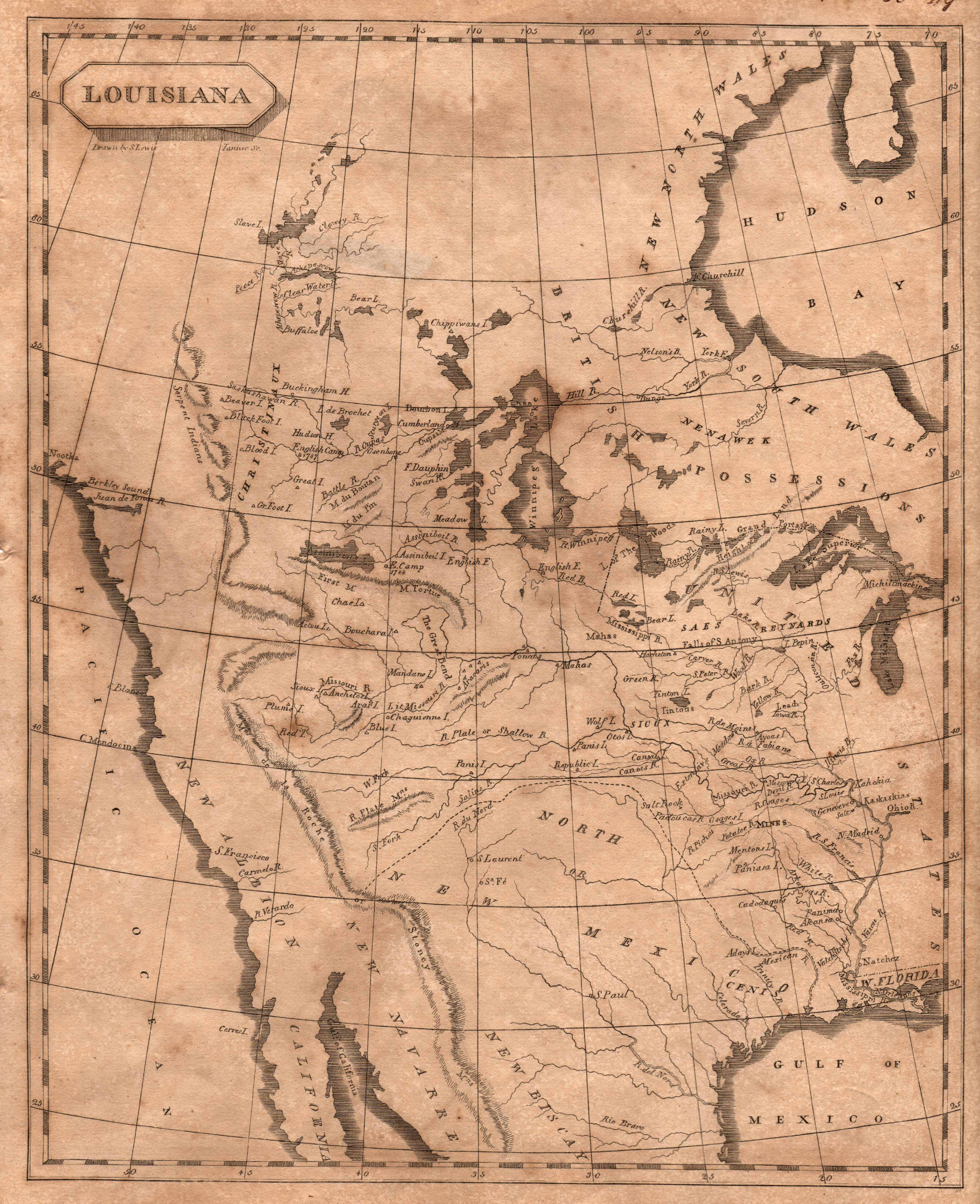
The classic map of 1804 produced by British cartographer Aaron Arrowsmith and American cartographer, Samuel Lewis (later cartographer for Lewis … See more Louisiana
Theme: Exploration (5 Maps with Images)
Show All Maps22
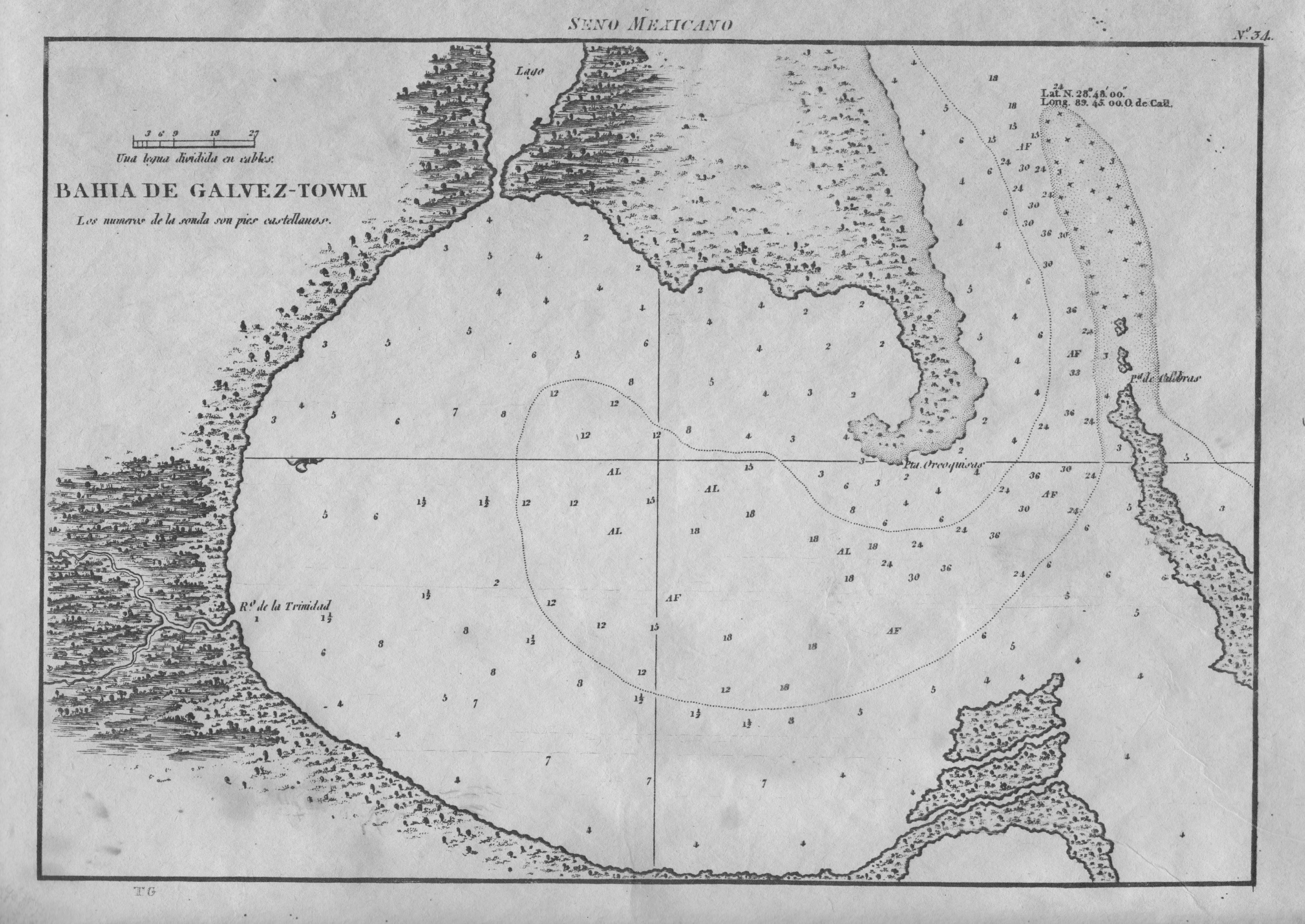
1809: Bahia de Galvez-Towm
Cartography:
Jose de Evia
Jose de Evia
Spanish naval chart, and the first map devoted specifically to Galveston Bay. It is based on Jose de Evia’s 1783-86 … See more Bahia de Galvez-Towm
23
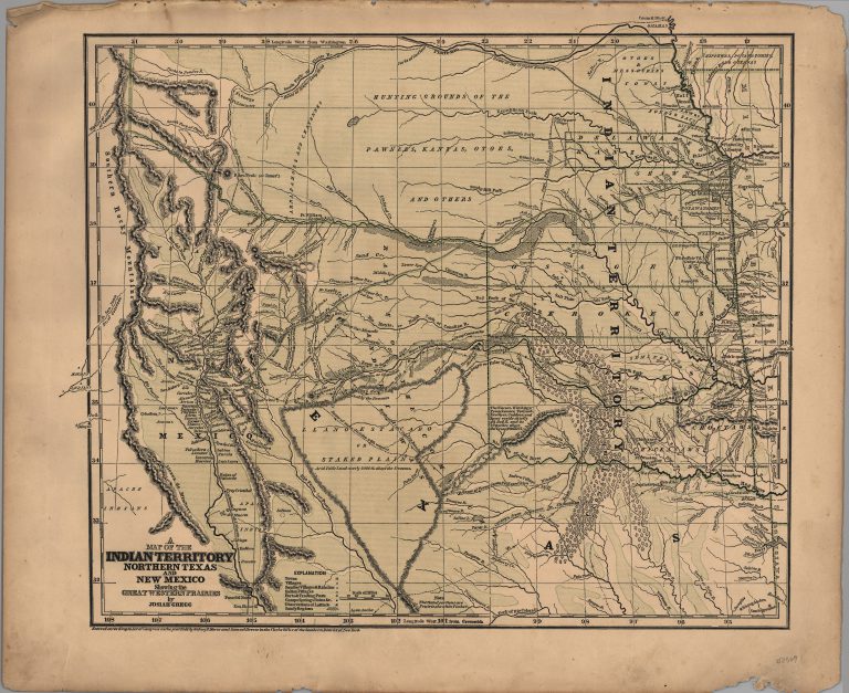
1844: A Map of Indian Territory, Northern Texas and New Mexico, showing the Great Western Prairies
Cartography:
Josiah Gregg
Josiah Gregg
This map was published by Josiah Gregg in his book Commerce of the Prairies in 1844 and in his Atlas … See more A Map of Indian Territory, Northern Texas and New Mexico, showing the Great Western Prairies
24
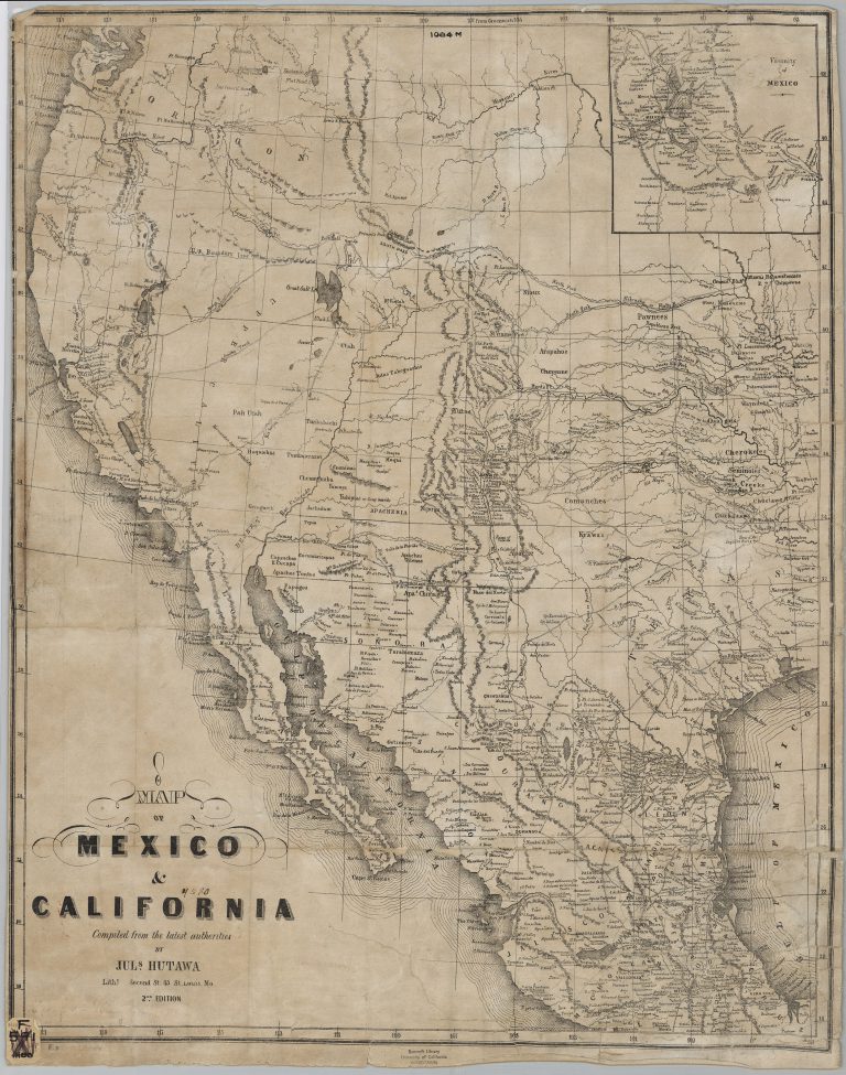
1849: Map of Mexico and California
Cartography:
Julius Hutawa
Julius Hutawa
Julius Hutawa was a lithographer and printer based out of St. Louis, Missouri. He specialized in making maps for western … See more Map of Mexico and California
25
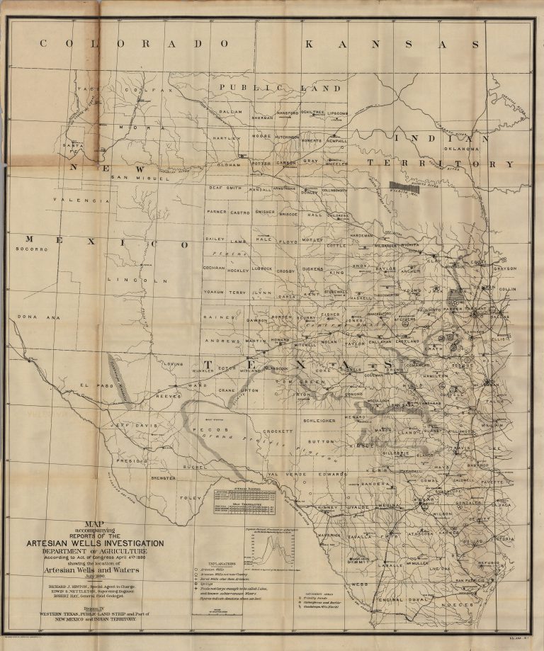
1890: Map Accompanying Reports of the Artesian Wells Investigation
Cartography:
Richard J. Hinton
Richard J. Hinton
Groundwater trapped below rock strata was essential to the development of the arid regions of the American West. This government-published … See more Map Accompanying Reports of the Artesian Wells Investigation