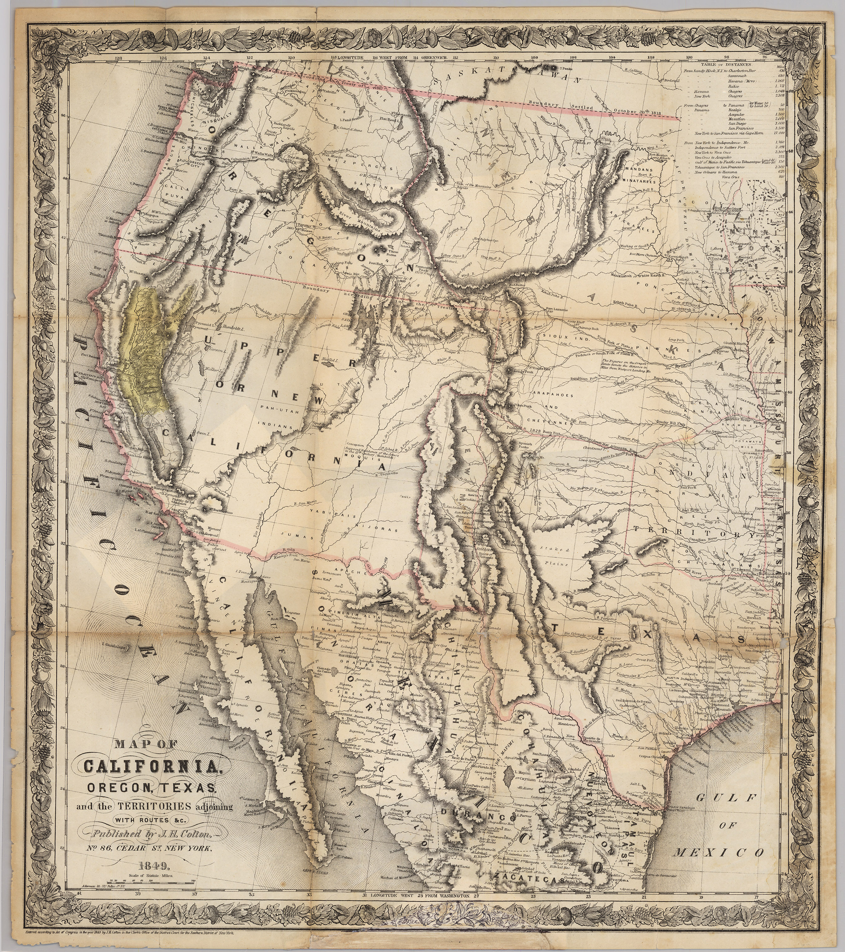
Joseph Hutchins Colton’s 1849 map is one of the most accurate of the period that was printed to satisfy the public demand for information on the routes to California and the region where gold had been found there. It has a large yellow splotch to indicate the “El Dorado” or the “Gold Region” of California.
1849 Map of California, Oregon, Texas, and the Territories Adjoining
Cartography: Joseph Hutchins Colton