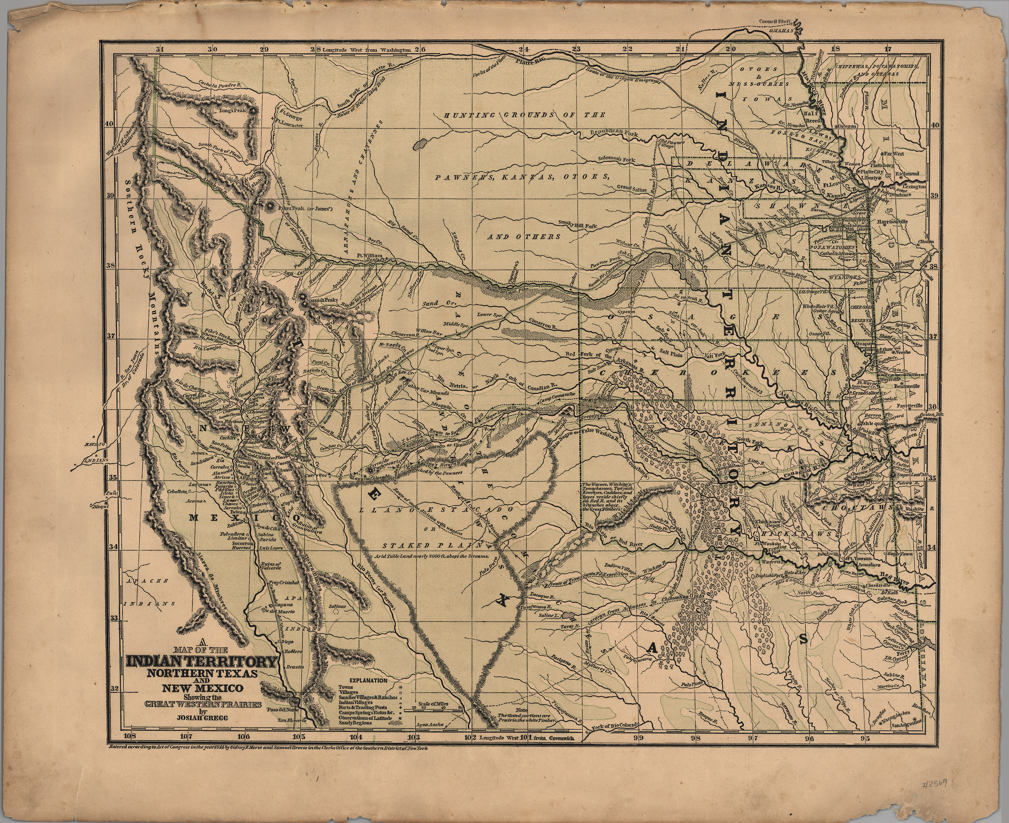
This map was published by Josiah Gregg in his book Commerce of the Prairies in 1844 and in his Atlas in 1845. Considered to be a landmark map, it combines information from Humbolt’s “New Spain” map of 1811, Major Long’s notes from his 1840 expedition, and J. C. Brown’s survey of the Santa Fe Trail in 1841 with personal observations by Josiah Gregg himself. The map was produced by Gregg, Sidney Morse and Samuel Breese using the newly-developed cerographic process, as indicated by the characteristic blue-line underlay.
1844 A Map of Indian Territory, Northern Texas and New Mexico, showing the Great Western Prairies
Cartography: Josiah Gregg