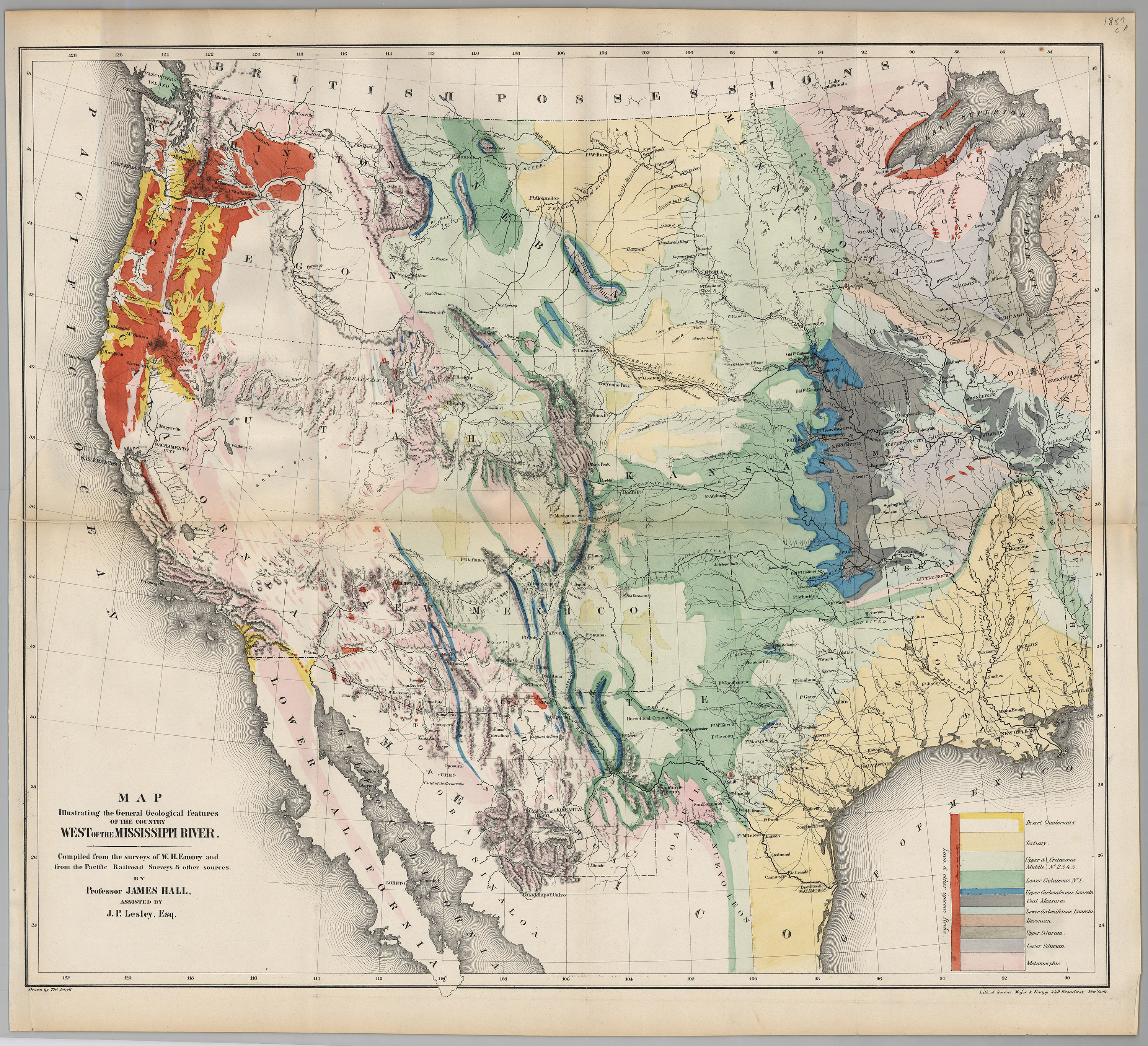
This map by Professor James Hall is one of the first geological maps of Western United States and Mexico. Based upon William Emory’s map, this 12-color geological map was included in Volume II of Emory’s Report on the United States and Mexican Boundary Survey of 1857. Professor Hall highlighted the mineral resources west of the Mississippi River and this map helped spur the westward migration, expansion and settlement of the United States.
1857 Map Illustrating the General Geological Features of the Country West of the Mississippi River
Cartography: J. P. Leslie, James Hall