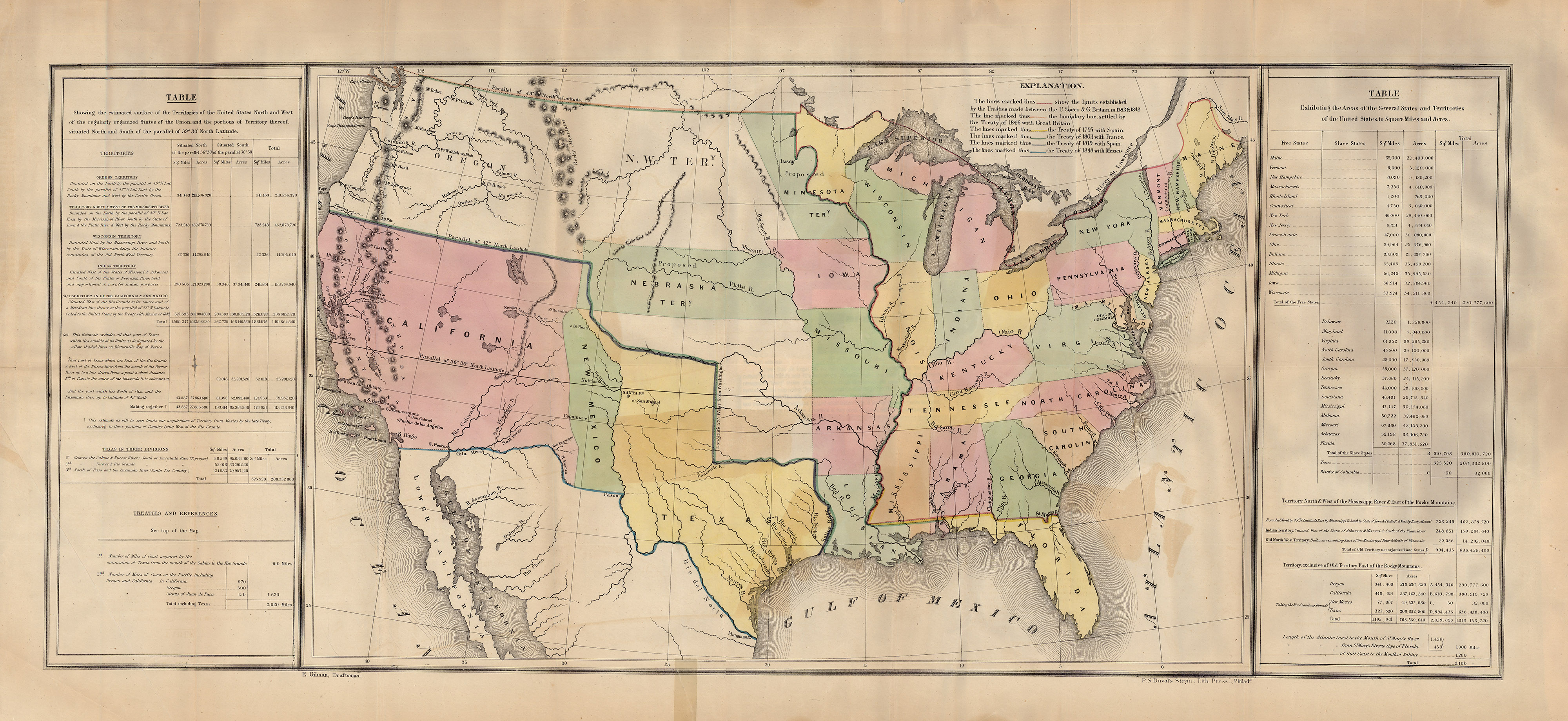
This map shows the United States following the US-Mexico War (1846-48), but prior to the Compromise of 1850 and the 1853 Gadsden Purchase. Acquisition of land to complete the nation’s westward “Manifest Destiny” movement is shown by treaties with foreign nations, and it illustrates well the rapid growth of the country through the mid-point of the 19th Century. Texas is shown with its maximum size, extending all the way to present-day Wyoming.
1848 Lines of Treaty Map of the United States between 1783 and 1848
Cartography: E. Gilman, U.S. Government